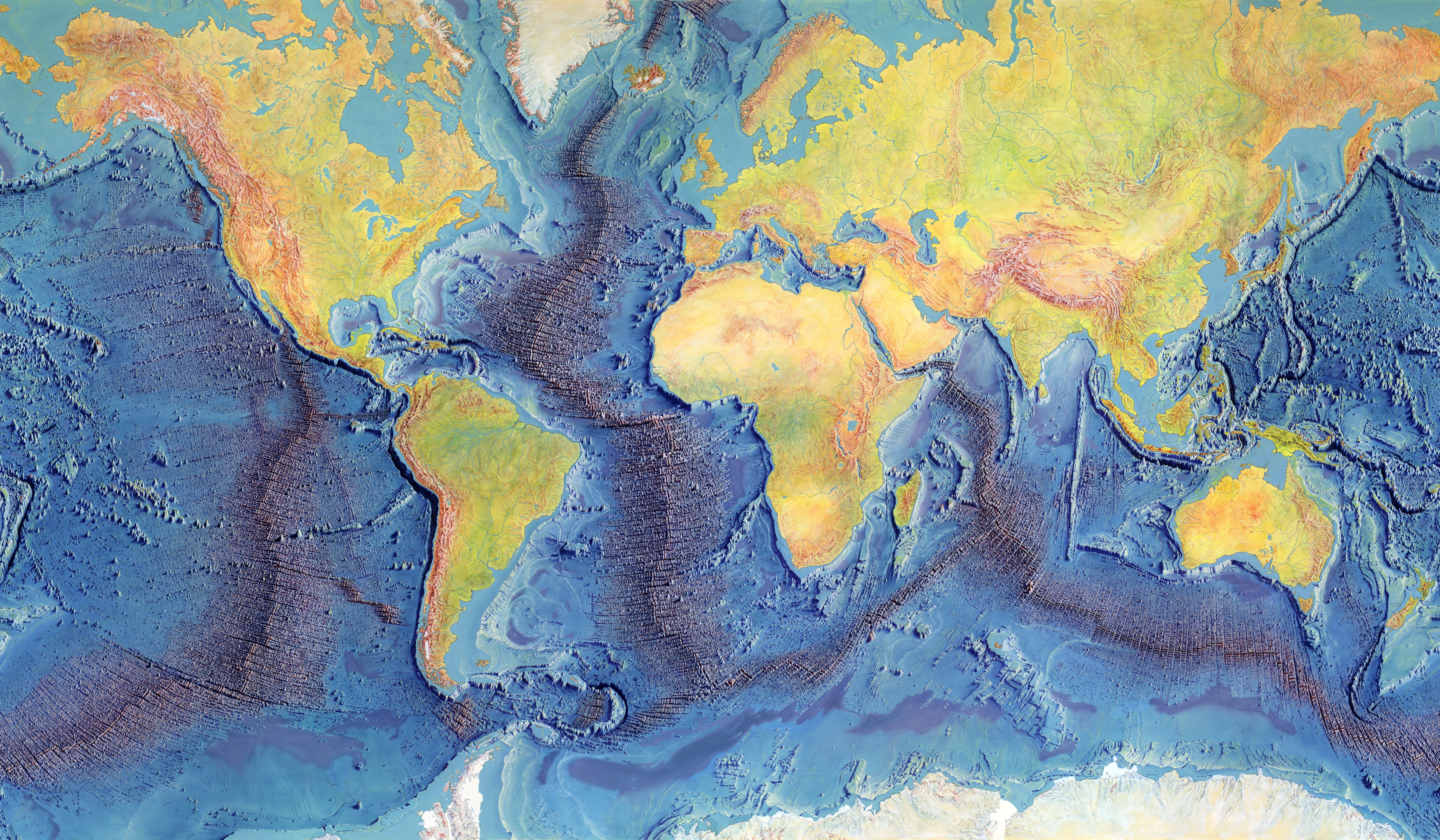
Tharp’s original world.
The 1977 map brings soundings, geological interpretation and Berann’s artistry together. Its shading and vertical exaggeration reveal the landscape; its image colors are not a numerical depth scale.
How the map was made ↗Marie Tharp’s maps began the inquiry.
Keep the original in view. Look closely at the terrain. Follow the data beneath it.
Bruce C. Heezen & Marie Tharp
Painted by Heinrich C. Berann
Drag to pan · scroll or pinch to zoom · keyboard + / − / arrows
Actual historical artwork, preserved without repainting. Profile locations, when shown, use approximate georeferencing. About the map and data ↓
Choose a crossing to inspect its elevation profile
and locate it on Tharp’s original map.
Loading the sourced profiles…
Move along the line, or use the slider’s arrow keys.
0.2° sampling · optional reference curve · no change to GMRT values
Elevations from the GMRT synthesis. This profile does not identify which individual points come from direct surveys or interpolation. The Wilkes crossing continues onto Antarctica’s surface.
The 1977 map brings soundings, geological interpretation and Berann’s artistry together. Its shading and vertical exaggeration reveal the landscape; its image colors are not a numerical depth scale.
How the map was made ↗The profile overlay uses an approximate geographic alignment of the historical image. It guides you to the region. It does not change the original artwork or make its placement survey-grade.
View alignment provenance ↗Four pinned GMRT transects provide actual elevation samples from its terrain synthesis. They are separate from Tharp’s historical soundings. Matching terrain is a starting point for testing a cause and date, with further evidence.
About GMRT at Lamont ↗