Chapter One: The Main Event
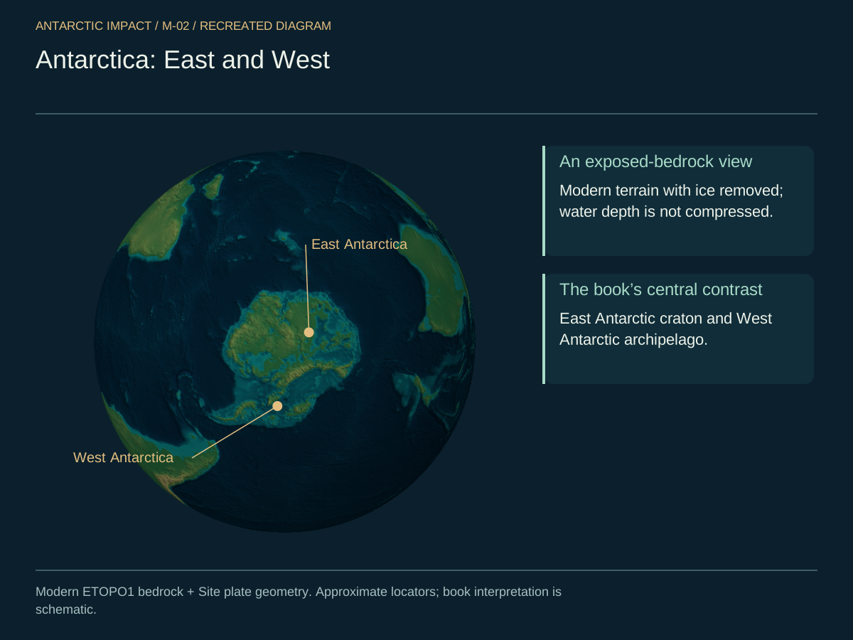
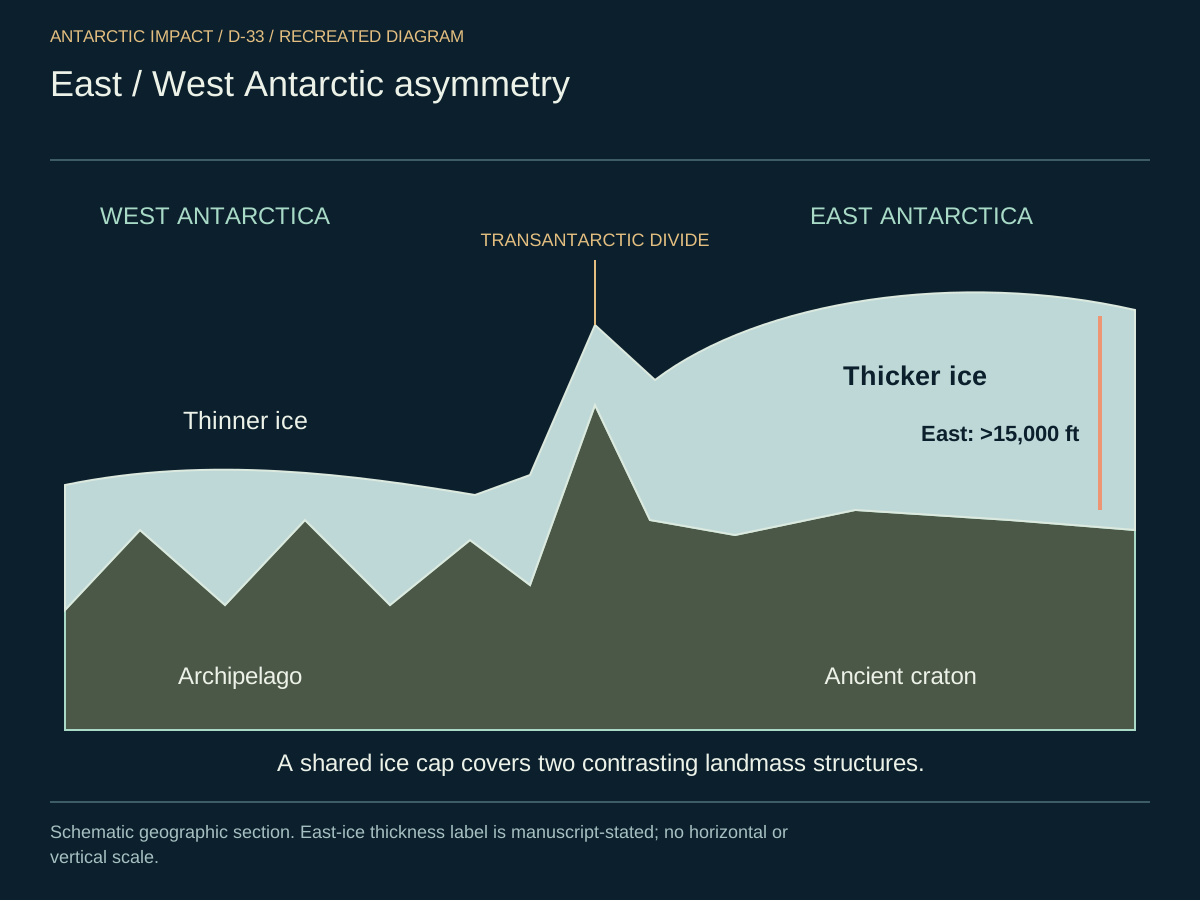
What do we really know about Antarctica? We know it is the highest and driest continent on Earth. We also know it is extremely cold, with an ice sheet that can be up to three miles thick in places — though that ice is not evenly distributed. In fact, it is dramatically asymmetric: the East Antarctic ice sheet exceeds fifteen thousand feet in places, while the West Antarctic ice is far thinner, and the thickness consistently leans toward the Indian Ocean side rather than toward South America. Beneath this ice, Antarctica is essentially two separate pieces of land — the East Antarctic craton, an ancient and stable block, and a West Antarctic archipelago of smaller landmasses now joined only by their common burden of ice.
Look at Antarctica honestly and you are looking at two continents under one ice cap. East Antarctica is an ancient block of stable crust; West Antarctica is a scatter of islands held together by the weight above them. That is not a small distinction. It is the first thing the rest of this book explains.
Here is the same picture from the side. East is the continental craton; West is the archipelago; the Transantarctic Mountains divide them, and the Wilkes Land mascon sits where the impactor came down.
We also know Antarctica was once at the core of a prehistoric supercontinent — the landmass traditionally called Pangea — which later fragmented into the continents we recognize today. The idea of continental drift was first proposed in the early twentieth century by Alfred Wegener, a German meteorologist. He was ridiculed for it, because no one could name a force powerful enough to move continents. This book names it.
A Massive Comet Collision
Here is what we are proposing. A colossal comet, five hundred kilometers across and made mostly of nitrogen ice, came down at the bottom of the world at tens of kilometers per second. The energy of that arrival — on the order of ten trillion megatons of TNT, tens of thousands of times the Chicxulub impact — cracked the crust of the unified supercontinent and propelled its fragments outward in different directions. The geology we walk around on every day is exactly what a body of that scale leaves behind.
Marie Tharp's undersea maps — particularly those published in National Geographic atlases — show the shape of it. In the 1981 edition of the National Geographic Atlas, pages 37–38 (Antarctica) show ripple-like arcs radiating across the Pacific Ocean basin. And one feature above all — the Ninety East Ridge in the Indian Ocean — marks the primary line of force from the comet's impact.
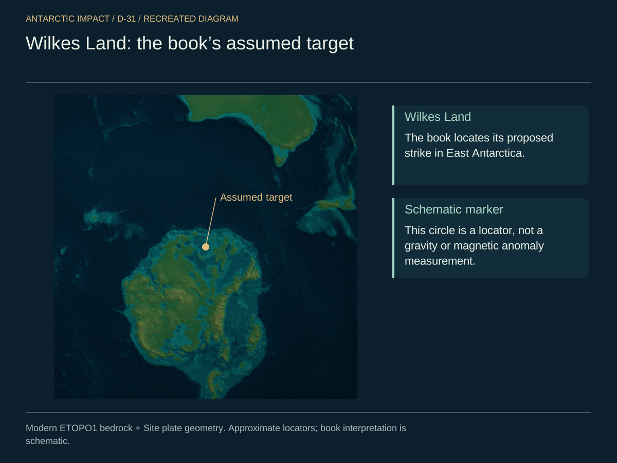
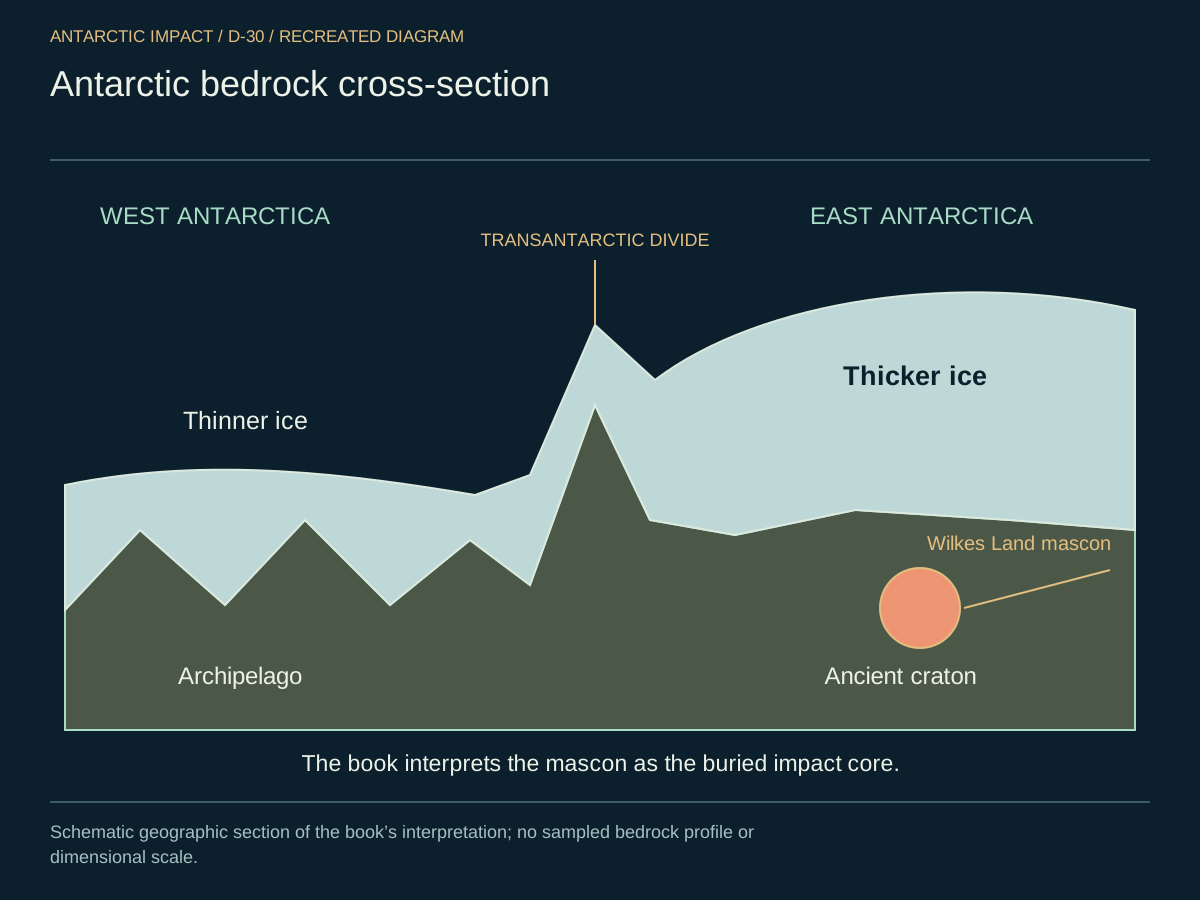
The buried evidence is striking. East Antarctica conceals what is called the Wilkes Land Anomaly — a roughly circular gravity-and-magnetic disturbance, on the order of three hundred kilometers across, with a mass concentration that says something extraordinarily dense is buried there. Detected by satellite and airborne magnetometer surveys, it is too big, too round, and too intense to be an ordinary intrusion of rock. It is the fossilized core of the impactor itself — the dense, compressed heart of the comet that survived atmospheric passage and now lies, sealed under miles of ice, at ground zero.
This is the central image of the whole book — what sits beneath the ice in East Antarctica, plotted from the gravity-and-magnetic data. Everything else in these pages radiates from this spot.
Picture the bedrock under the ice the way an engineer would. The ice column is miles thick on the eastern side and far thinner on the west. The Transantarctic rift runs between them. And the mass concentration we just talked about — the Wilkes Land mascon — is marked where the core came to rest.
The Ninety East Ridge and the Himalayas
Now here is the piece that, the first time I saw it on a Tharp map, stopped me cold. Indian Ocean bathymetry shows a ridge — the Ninety East Ridge — running five thousand kilometers in a near-perfect straight line, and pointing precisely at the Great Bend of the Himalayas. Straight lines are not what slow processes produce. Straight lines are what a single force produces, applied once. This is the smoking gun.
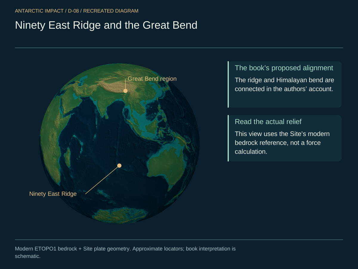
The comet struck Earth at an angle of around twenty-three degrees, sending a primary shock wave toward the region now known as the Great Bend of the Himalayas. As the force of the impact "plasticized" — briefly softened — the Earth's crust, the Indian subcontinent and the Australian Plate separated, while the Eurasian Plate was thrust upward, forming the towering Himalayas.
The physics of plasticization is well understood. Silicate rock shifts into plastic deformation above pressures of roughly ten gigapascals and temperatures above about a thousand degrees Celsius. Near the strike point, an impact of this scale drives pressures past a hundred gigapascals and temperatures past ten thousand degrees — deep into the plastic regime for a brief but decisive window. Long enough for continents to slide and mountains to fold without crumbling, and then to "freeze" in their new configuration as the crust cooled.
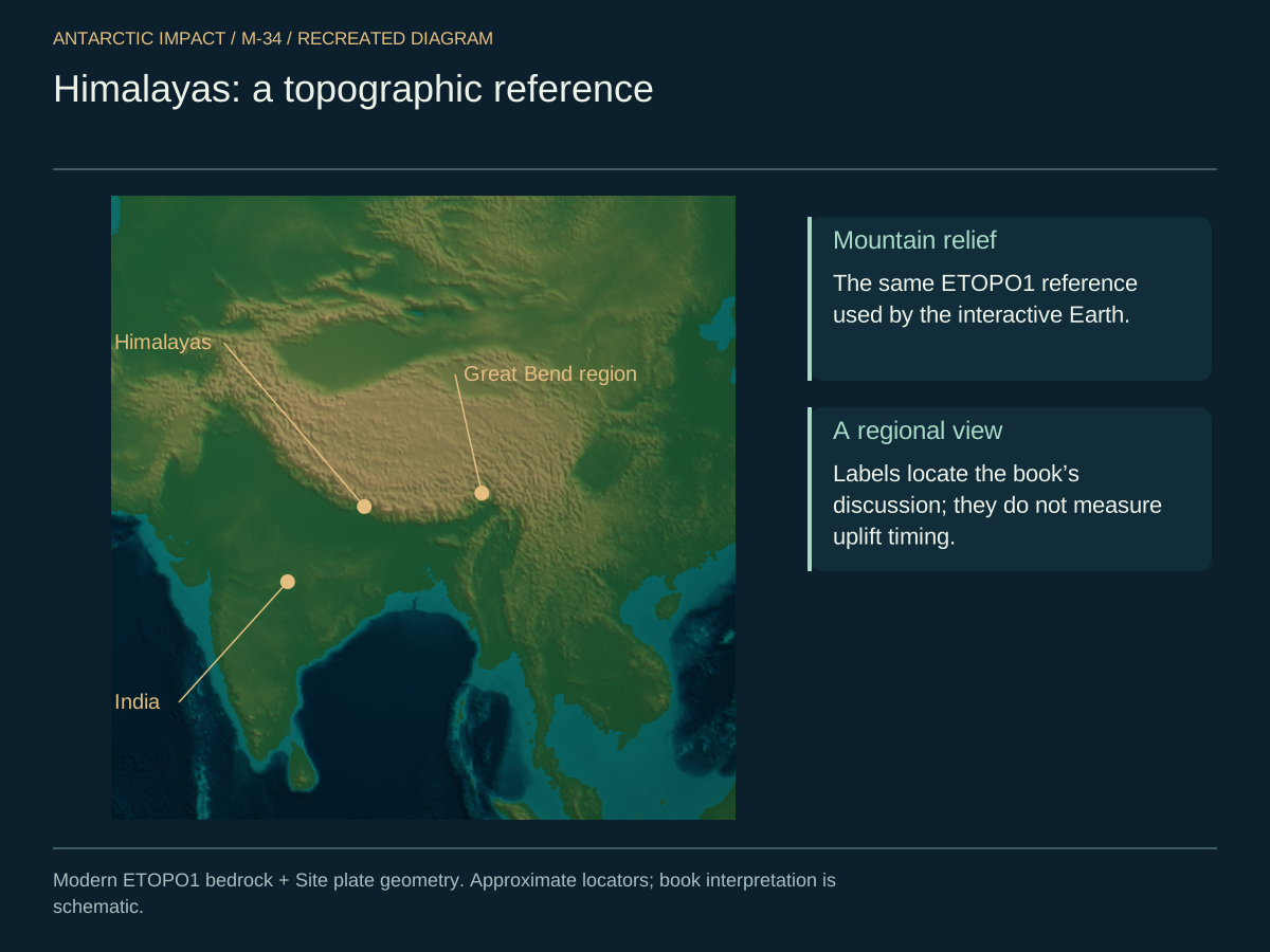
A global "land wave" traveled around the planet, with different landmasses experiencing varying degrees of uplift. We return to the Himalayan case — heights, marine fossils, Great Bend alignment — as part of the global fracture pattern in Chapter Two. For now it is enough to say that the major geographical structures we see today — mountains, ocean basins, rift zones — trace back to a single, pivotal event.
Look at the topography of the Himalayas themselves. The chain is too high, too concentrated, and too sharply curved at the Great Bend to be the slow product of creep. It is the product of a blow.
The World Before
The Ninety East Ridge is a direct scar, aligned with the comet's trajectory. And the same blow set the planet's lean. Before the impact, Earth turned with little or no axial tilt — a world without seasons, day and night the same length everywhere, the tropics warm and the poles steady. The present 23.5-degree tilt is the impact's signature, written into the spin of the planet itself: the energy that fractured Pangea also nudged Earth's axis into its modern orientation.
Take the southern continents — South America, Africa, Australia — and reverse their trajectories. They do not gather into the familiar Pangea. They cluster around Antarctica, like petals folded back toward a single bud. The present continental fan is, in geometry, exactly what a force pushing outward from a southern polar point produces.
Geological evidence around the globe records a rapid reconfiguration of Earth's surface. Ancient whale bones have been reported at high elevations in the Himalayas by early twentieth-century expeditions. Regions like the Sichuan Basin in China contain extensive dinosaur fossil beds — the remnants of marine incursions that drained eastward after land in Asia was abruptly uplifted. Rivers such as the Yangtze, Irrawaddy, Salween, and Mekong carved their courses through newly raised terrain.
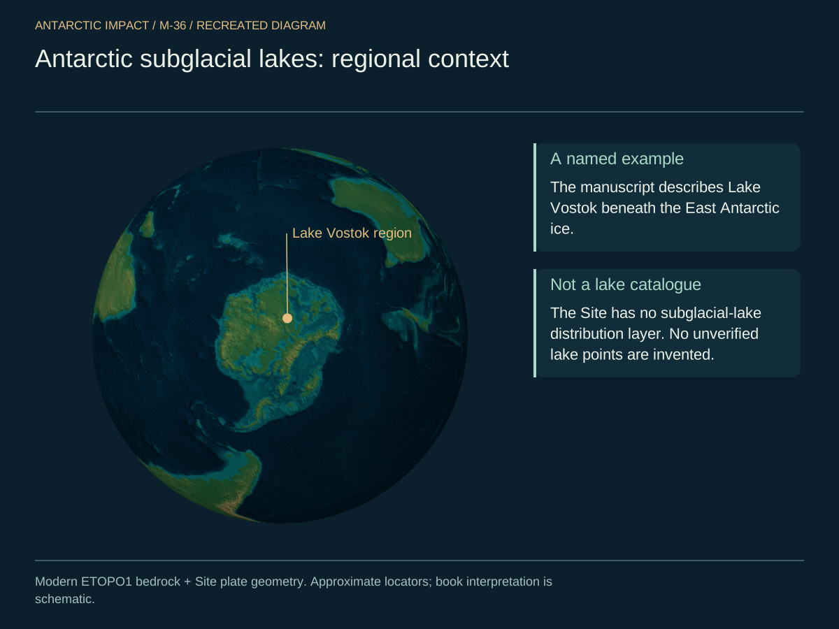
There is one further set of clues that few popular accounts mention. Radar mapping beneath the Antarctic ice has revealed river valleys carved into the bedrock, lake basins with sediment patterns laid down by standing liquid water, and weathering signatures that look temperate rather than polar. There are more than four hundred known subglacial lakes; Lake Vostok alone holds something on the order of thirteen hundred cubic miles of liquid water beneath roughly four kilometers of ice.
Look at the distribution. Four hundred-plus lakes, plotted on a polar projection — not the picture of a continent that has been frozen solid for hundreds of millions of years.
And in cross-section: liquid water at the rock-ice interface, sealed under miles of ice, warmed from below by a continent that has not yet finished cooling.

Marie Byrd Land shows heat flow about three times the typical continental value — far higher than a long-frozen, geologically quiet continent could display, and exactly what the residual heat of an impact looks like. Antarctic extremophiles — bacteria, algae, even the fish in those subglacial lakes — show genetic lineages consistent with isolation for thousands, not millions, of years.
Every one of these observations says the same thing. This continent's deep freeze is young.
Then there is the matter of coal. Antarctica's Beacon Supergroup, and the Permian coal in the Prince Charles Mountains, constitute one of the largest coal deposits on Earth. Coal of that volume and quality requires dense vegetation, a warm and humid climate, and stable burial. Antarctica was, until very recently, green. What we are looking at is not the residue of unimaginably ancient forests but the burial layer of the catastrophe itself.
The Day the World Changed
These massive changes occurred recently — somewhere in the window of roughly thirteen thousand to fifteen thousand years ago — driven by a wave of enormous nitrogen-ice comets, the largest on the order of five hundred kilometers in diameter, that struck bodies across the solar system. The bombardment triggered the Ice Age, wiped out the lingering dinosaur populations, and dramatically altered Earth's climate. In later chapters, we explore the evidence of human survivors and the cultural memories that preserve this cataclysm.
The "main event" at the heart of our theory is this massive comet impact in Antarctica, which plasticized Earth's crust, molded mountains, carved valleys, and sculpted oceans as we know them. It flung huge amounts of nitrogen ice across the globe, initiating widespread glaciation and ushering in a dramatic climatic shift — the Ice Age. In its aftermath, sea levels rose by roughly three hundred feet, climates changed, and humanity entered a new and transformed world.
Here is the whole sequence in one figure — the spine of the day in question. From a day before contact through the twenty-four hours afterward: approach, first contact at Wilkes Land, plasticization at one second, the Ninety East Ridge fracture at ten seconds, India and Eurasia colliding at one minute, the Himalayas rising at ten minutes, global volcanism at one hour. We have no witness for it — only the rock, which recorded all of it.

Antarctica as the Smoking Gun
We close this chapter where we will keep returning: to Antarctica itself. Two landmasses fused under one ice cap. Coal beneath that ice. Subglacial lakes and elevated heat flow. A circular, hyper-dense mass concentration in Wilkes Land. A continent toward which the southern landmasses point like compass needles when you trace them backward in time. An ice sheet whose thickest lobe faces the Indian Ocean, in exactly the direction the Ninety East Ridge points back. Together, they describe a crime scene. The weapon is still in it.