THE BOOK, BEYOND EARTH

Other worlds.
A wider frame.

Immense basins. Frozen plains. A moon like a sponge. Visit seven worlds from Antarctic Impact through the cameras of the missions that reached them.

Each image has its own history. Look at the spacecraft record, then follow the connection the authors make in Chapter Three.

Begin with Mars
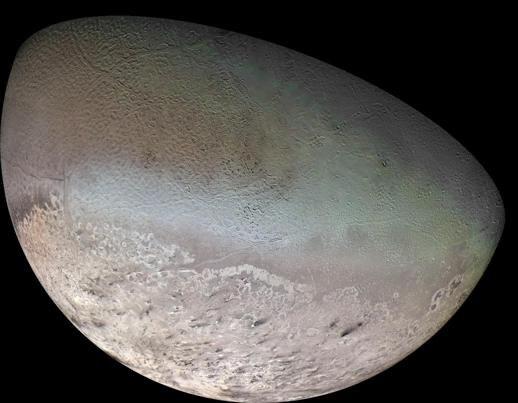
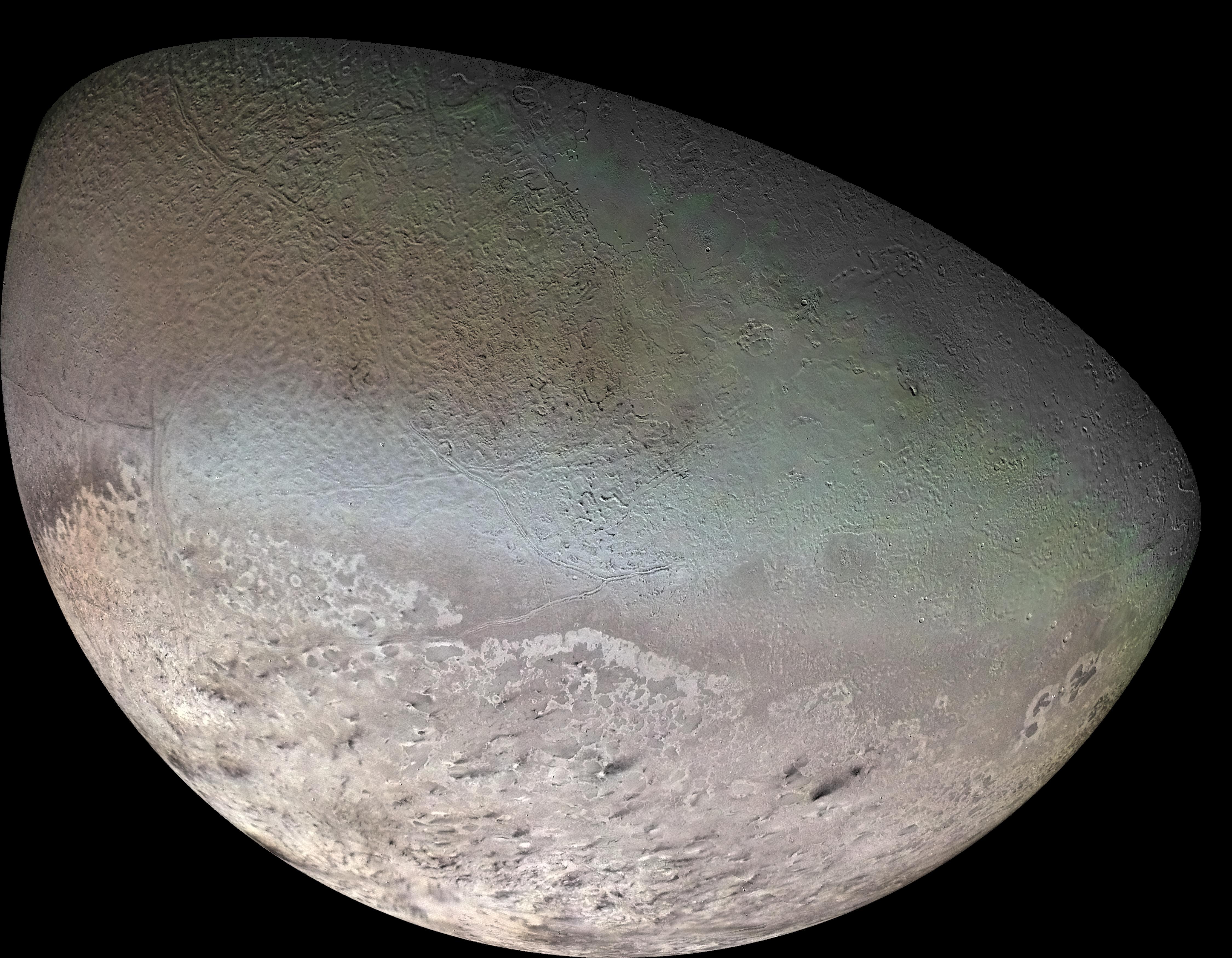
Voyager 2’s synthesized-color mosaic of Triton, with a pale southern cap and textured terrain.
TRITON · VOYAGER 2 · 1989Synthesized-color camera mosaic
NASA/JPL/USGS · Image record ↗
JUMP TO A WORLD

Look, compare, investigate. These are mission photographs, camera mosaics and a lunar laser-altimetry map, with their processing identified. They document real features; the book’s proposed common comet swarm is a separate interpretation. Images alone do not establish a shared event or a shared date.

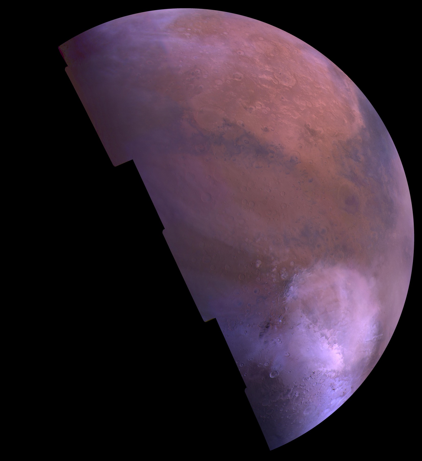
01MARS / HELLAS IMPACT BASIN

Hellas, under seasonal frost

Viking color mosaic of Mars: a pale frost-covered Hellas basin lies toward the bottom of a mauve and rust-colored partial globe.
Color photographic mosaicNASA/JPL/USGS

What the mission shows

Viking resolves the vast Hellas depression in Mars’s southern hemisphere. In this seasonal view, bright carbon dioxide frost fills part of the basin.

How the book connects it

Chapter Three compares Hellas with Antarctica and connects its impact to Tharsis and the proposed comet swarm.

Image record & processing
Mission
Viking Orbiter 1
Acquired
1980
Published
1998-06-08

About 50 red-, green- and violet-filter camera frames, combined in an orthographic projection. The bright area within Hellas is carbon dioxide frost.

02MOON / SOUTH POLE–AITKEN BASIN

The Moon’s immense far-side basin

A false-color laser-altimetry view of the lunar far side: the deep South Pole–Aitken basin appears blue and purple amid orange and red highlands.
False-color topographic visualizationNASA/Goddard Space Flight Center Scientific Visualization Studio

What the mission shows

LOLA measured the immense depression on the lunar far side. In this map, blue and purple reveal the low basin while red marks higher surrounding terrain.

How the book connects it

Chapter Three places this basin in its comparison of large impact features across several worlds.

Image record & processing
Mission
Lunar Reconnaissance Orbiter · LOLA
Acquired
2009-07-13 to 2009-12-17 (LOLA data range)
Published
2010-06-11

A data visualization from Lunar Orbiter Laser Altimeter measurements, not a photograph. Blues and greens encode low elevations; reds encode high terrain. This SPA frame uses early LOLA topographic results.

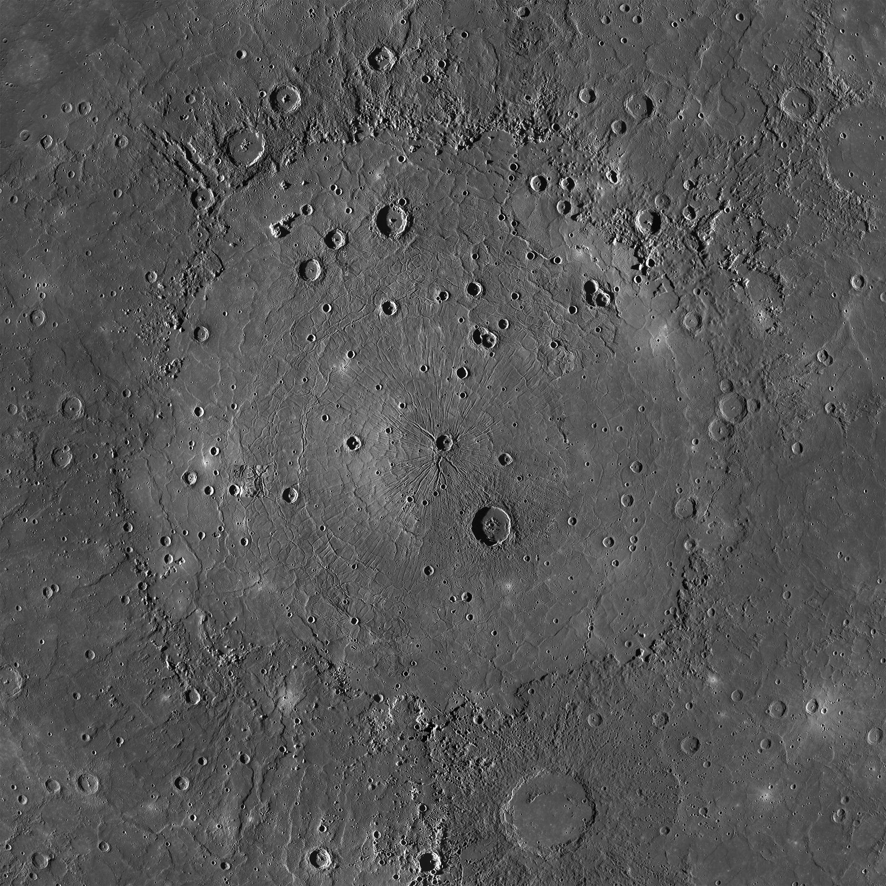
03MERCURY / CALORIS BASIN

Inside Caloris

A grayscale MESSENGER mosaic of Caloris, with a bright, broadly circular basin floor, many later craters and rugged surrounding terrain.
Grayscale photographic mosaicNASA/Johns Hopkins University Applied Physics Laboratory/Carnegie Institution of Washington

What the mission shows

MESSENGER shows Caloris’s broad interior plains, later impact craters and a complex record of deformation and volcanic filling.

How the book connects it

Chapter Three compares Caloris and its antipodal terrain with the book’s impact-and-uplift mechanism.

Image record & processing
Mission
MESSENGER
Acquired
Not stated on the source page
Published
2015-02-23

MDIS camera imagery assembled in an orthographic projection at 250 metres per pixel. The source identifies the mosaic center as 31.5°N, 162.7°E; acquisition dates are not supplied.

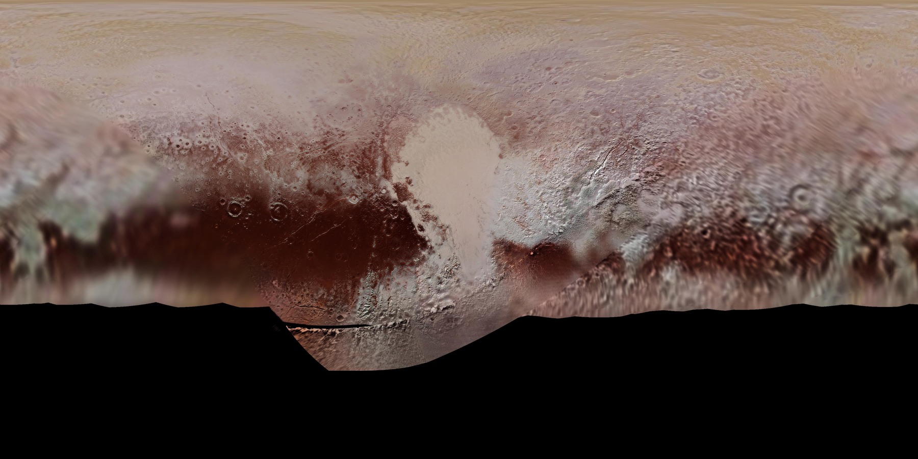
04PLUTO / SPUTNIK PLANITIA

The heart, in a global map

A rectangular global color map of Pluto with bright Sputnik Planitia in the center, red-brown terrain to the south and varying image detail across the map.
Projected color photographic mosaicNASA/Johns Hopkins University Applied Physics Laboratory/Southwest Research Institute

What the mission shows

New Horizons mapped Sputnik Planitia as the bright western lobe of Pluto’s heart-shaped region. Its outline sits within a varied, colored landscape.

How the book connects it

Chapter Three uses Pluto’s nitrogen-rich glacier as an analogy for the book’s proposed delivery of cometary nitrogen ice to Earth.

Image record & processing
Mission
New Horizons
Acquired
2015-07
Published
2017-01-19

A projected global map assembled from three-filter Ralph/MVIC observations. North is up; coverage and resolution vary across the map. This is not a single photograph.

05TRITON / SOUTHERN TERRAIN AND POLAR CAP

Frost and dark streaks

Voyager’s synthesized-color Triton mosaic shows a pinkish southern polar cap, dark streaks and greenish textured terrain.
Synthesized-color photographic mosaicNASA/JPL/USGS

What the mission shows

Voyager 2 revealed a polar cap and dark streaks associated with plume deposits on a world with nitrogen frost. The mapped terrain is varied rather than featureless.

How the book connects it

Chapter Three connects Triton’s volatile surface and sparse cratering with the proposed nitrogen-ice swarm.

Image record & processing
Mission
Voyager 2
Acquired
1989
Published
1998-06-04

Orange-, violet- and ultraviolet-filter images are displayed as red, green and blue. These colors emphasize surface differences and are not a human-eye color view.

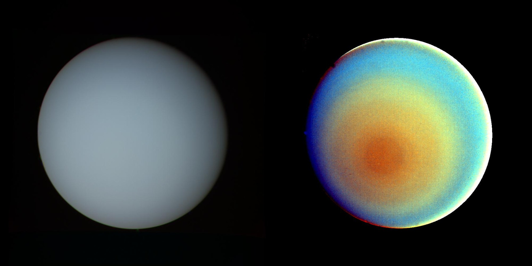
06URANUS / VOYAGER’S POLAR VIEW

One planet, two ways of seeing

Two side-by-side Voyager views of Uranus: a pale blue-green true-color disk on the left and a strongly enhanced orange and blue polar view on the right.
True-color and false-color compositesNASA/JPL

What the mission shows

The same atmosphere looks quiet in approximate true color and banded when false color and contrast reveal subtle polar structure.

How the book connects it

Chapter Three interprets Uranus’s extreme axial tilt as another consequence of the proposed comet wave.

Image record & processing
Mission
Voyager 2
Acquired
1986-01-17
Published
1996-08-01

Left: blue, green and orange filter frames approximating human-eye color. Right: ultraviolet, violet and orange frames with strong contrast enhancement; the bright limb is a processing artifact.

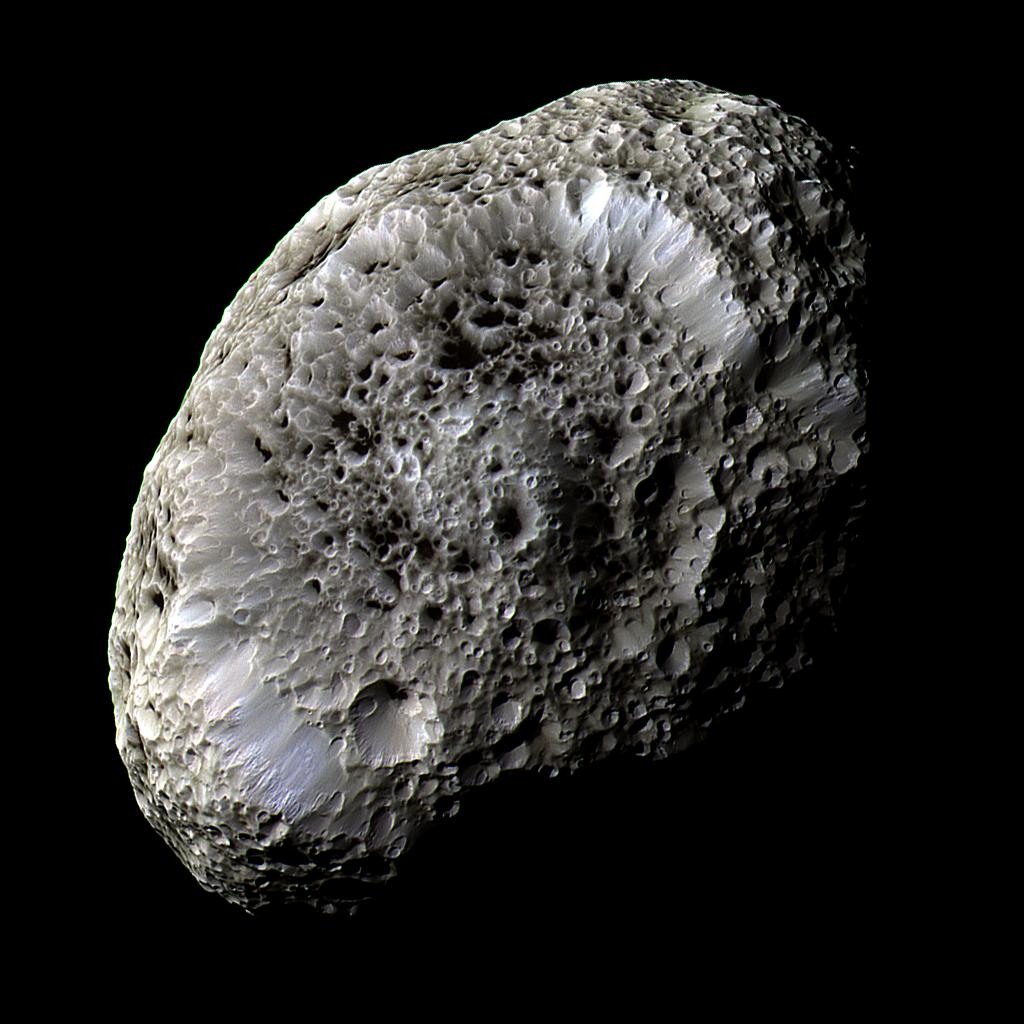
07HYPERION / SATURN’S POROUS MOON

A moon full of cavities

Cassini’s false-color close-up of irregular Hyperion shows a sponge-like surface covered with deep, sharp-edged craters and dark crater floors.
False-color photographic compositeNASA/JPL-Caltech/Space Science Institute

What the mission shows

Cassini’s close encounter exposes Hyperion’s distinctive craters. Low density, porosity and weak gravity help explain the unusual surface appearance.

How the book connects it

Chapter Three treats Hyperion as a possible surviving relative of the hypothesized comet and places it in Saturn’s wider moon-and-ring story.

Image record & processing
Mission
Cassini
Acquired
2005-09-26
Published
2019-01-30

Infrared-, green- and ultraviolet-filter frames were combined, with the natural reddish color reduced and other differences enhanced. Image scale is 362 metres per pixel.

08 / CHAPTER SIX / AN OPEN HYPOTHESIS

Beyond the last
photographed world.

Planet Nine has not been discovered. The hypothesis uses the orbits of distant objects to ask whether another planet could be shaping the outer solar system.

Chapter Six connects that proposed planet to the origin of the comet swarm. The book’s orbit diagram lets you explore the idea; it is a schematic, with illustrative parameters, rather than an observed orbit.

The book’s schematic of a possible Planet Nine orbit, an illustration of a hypothesis.
BOOK-BASED INTERACTIVE DIAGRAM · HYPOTHETICAL ORBIT
KEEP THE CONNECTIONS IN VIEW

From the spacecraft
back to the story.

Follow the authors’ argument in the chapter, compare its geometry in the interactive diagrams, or inspect the source images in the library.

About these comparisons. Book connections follow Chapters Three and Six of the retained Vision Edition manuscript. The September 2026 Online chapter reader is a separate edition. Mission descriptions here are editorial summaries linked to the original image records. The images have only been proportionally resized and encoded for the web; their original scientific processing is described with each record.

NASA imagery is presented as credited research material. NASA, JPL and the mission partners do not endorse the book or its interpretation. NASA media-use guidance ↗