Chapter Five: The Antarctic Impact and the Human Memory
Introduction
In previous chapters, we described how a massive cometary impact at Antarctica — around thirteen to fifteen thousand years ago — dramatically reshaped Earth's surface. A cataclysm this recent echoes in human memory: in myth, in legend, and in the archaeological record. This chapter follows a date that surfaces again and again — roughly fourteen and a half thousand years ago — across cultures worldwide. We also visit the earliest sites, such as Jericho and Göbekli Tepe, the drowned coastlines where the pre-impact world once lived, and the researchers, like James Churchward, who went looking for a lost world before anyone knew where to look.
Pinpointing the Convergence Date: Early Civilizations and Sites
A date that emerges repeatedly in mythological and archaeological contexts is roughly fourteen and a half thousand years before present (corresponding to about 12,500 BC in the older calendar). Numerous cultural remains record human activity in this timeframe. Some examples include:
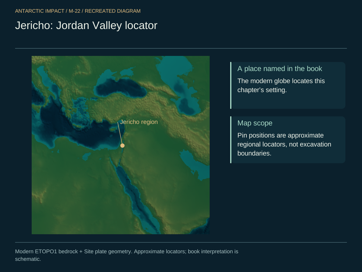
- Jericho (Israel). Archaeologists place its earliest settlement around twelve thousand years ago, with evidence of wild cereals and the origins of agriculture. Jericho lies below sea level in the Jordan Valley, fed by abundant water sources.
And the next site we keep returning to — Göbekli Tepe, whose sheer date and sophistication announce a people who were already builders when the world was remade.

- Morocco. The Mechta-Afalou remains link to Berber origins around seven thousand years ago or earlier, with connections to ancient Egypt that deepen the timeline.
- Central Asia. Neanderthal findings near Samarkand date to roughly forty-two thousand years ago, with later steppe cultures like the Botai (in present-day Kazakhstan) appearing around five and a half thousand years ago.
- Brazil. Sites such as Monte Alegre feature black-painted rock art twelve thousand years old. Some theories propose settlement (via the Pacific or Bering Strait) as early as twenty-seven to thirty-seven thousand years ago.
- Ubaid Culture (Mesopotamia). Emerges around seven thousand years ago, paving the way for the Sumerian civilization by six thousand years ago.
- Panama. Human occupation by thirteen thousand years ago, with coastal resources supporting early settlements.
- Bolivia. The Altiplano region shows signs of human habitation by about six thousand years ago, featuring advanced agriculture predating the Inca.
- Taiwan. Remains dating to around twelve thousand years ago, tied to Austronesian migrations across the Pacific islands.
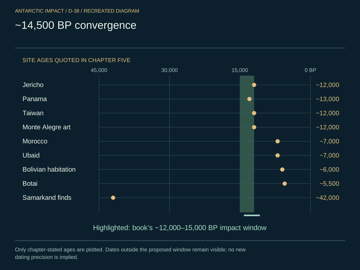
Many of these cultures — in Israel, Brazil, Panama, Taiwan, and elsewhere — show date ranges clustering between roughly twelve and fifteen thousand years ago, aligning with the Antarctic Impact.
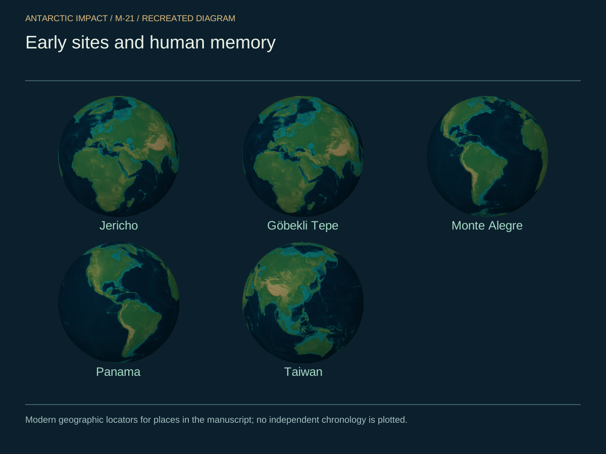
Put the early sites on one map. Jericho, Göbekli Tepe, Monte Alegre, Panama, Taiwan, and the rest — the cluster around twelve to fifteen thousand years ago is a global pattern, not a local one.
And here is the same convergence as a diagram — the cluster of independent date-anchored sites against the impact window. The pattern is what we keep coming back to.
The Drowned World
The list above looks short — and that is part of the story. There ought to be more sites of pre-impact human occupation, and there are: we just have not yet drained the sea to look.
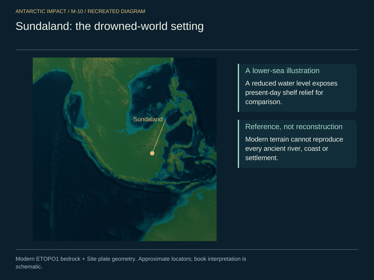
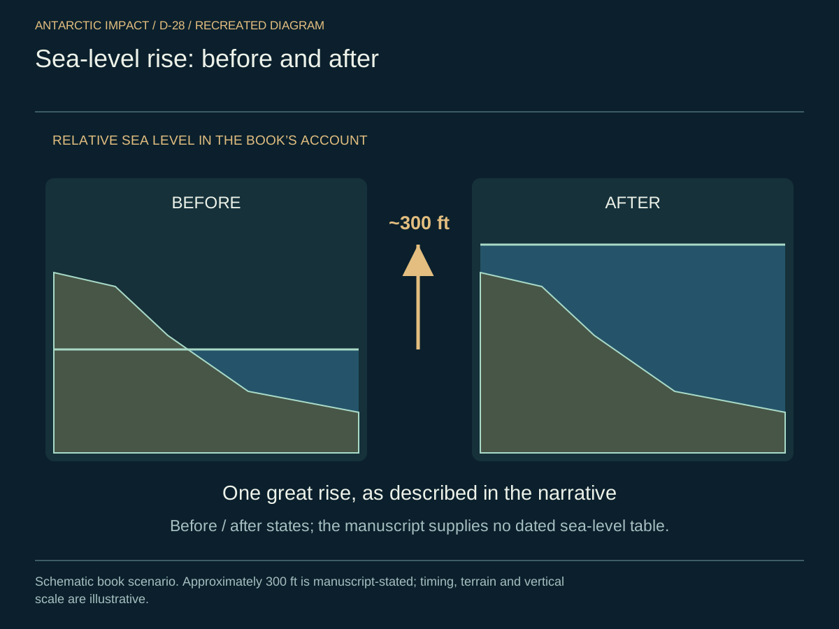
With sea levels roughly three hundred feet lower than they are today, the choicest real estate on Earth was not where we currently look. It was on the continental shelves. Four regions in particular stand out, and all four are now well mapped bathymetrically.
- Sundaland. The Southeast Asia–to-Australia continental shelf, dry pre-impact, joining what is now Indonesia, Malaysia, and the Philippines into one continuous landmass.
- Sahul. Australia–New Guinea bridged into a single continent, above water and habitable, with broad coastal plains where there is now sea.

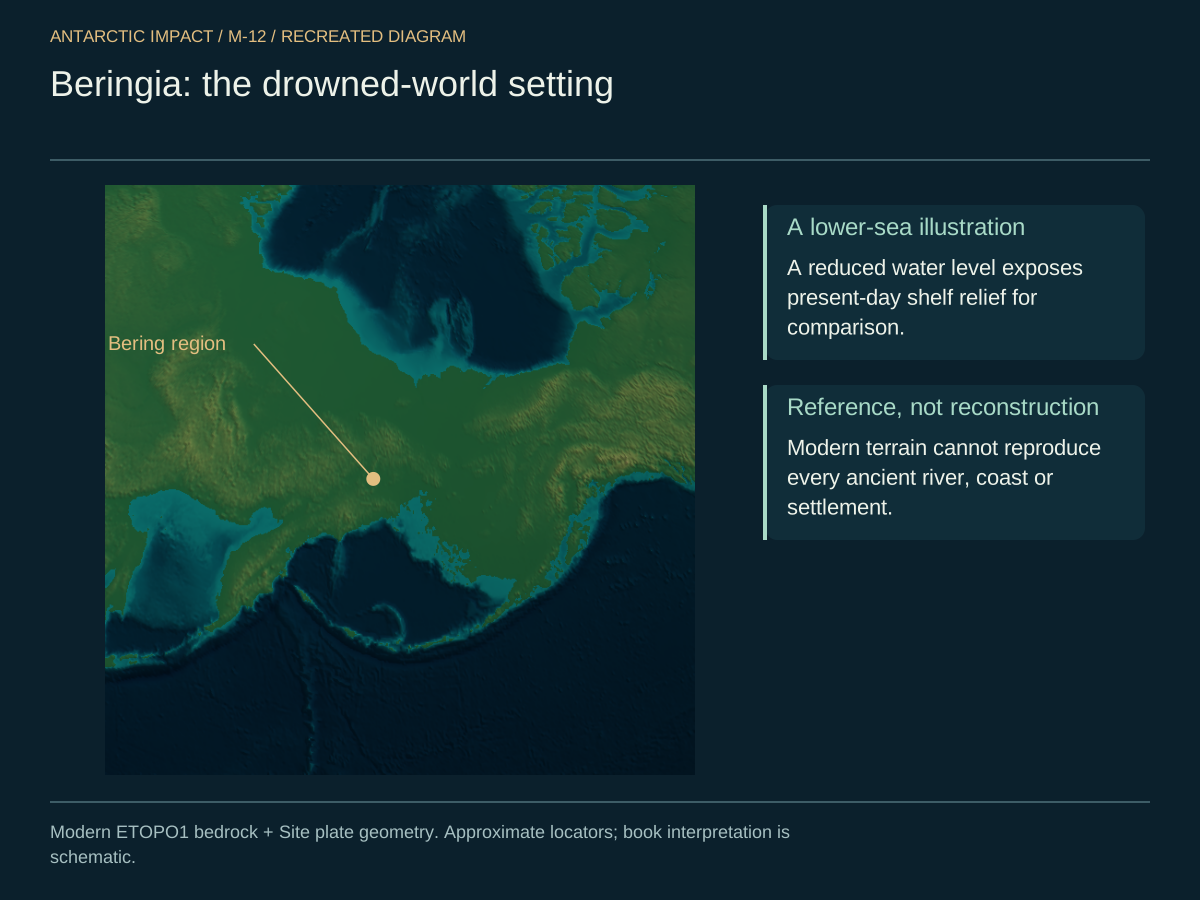
- Beringia. Alaska–Russia connected as a grassland corridor — the highway by which humans entered the Americas — now under the Bering Sea.
- Doggerland. The Britain–to–Continental-Europe shelf, supporting thriving settlements with rivers, lakes, and game, now drowned beneath the North Sea.

Put the four on one composite and you start to see the scale of what went under.

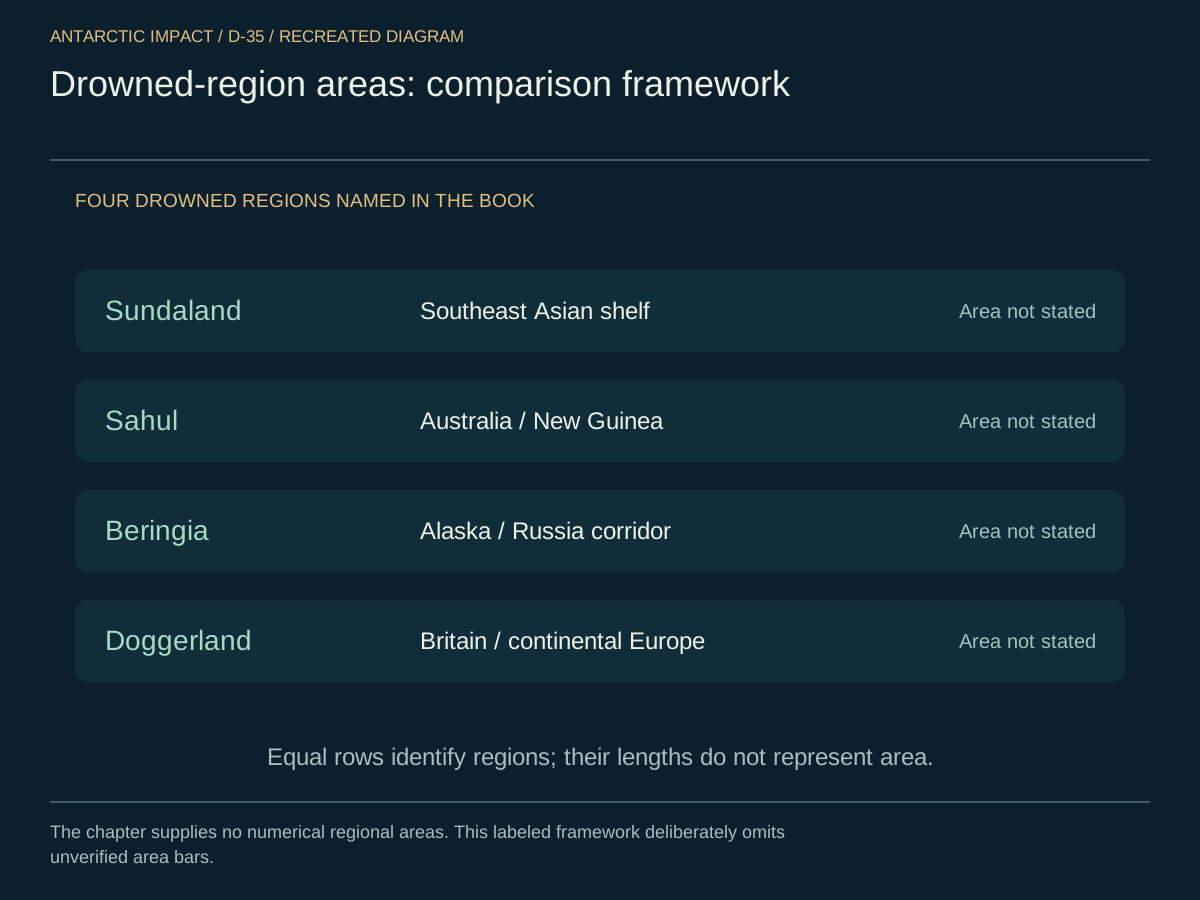
In areas, here is what disappeared. Sundaland, Sahul, Beringia, Doggerland, plotted as bars. The total drowned land is far larger than anyone who only knows the dryland map expects.
And here is the sea-level curve itself — the depth of the post-impact ocean as a function of time. The roughly three-hundred-foot rise is the shape of a single great melt, and the rate is the signature of a blow, not a thaw.
All four of these went under water in the same broad event. The "archaeological silence" before about fourteen thousand years ago — the strange thinness of the human record in that window — is an artifact of having flooded the evidence locker. The cities are not missing. They are wet.
Where to Look
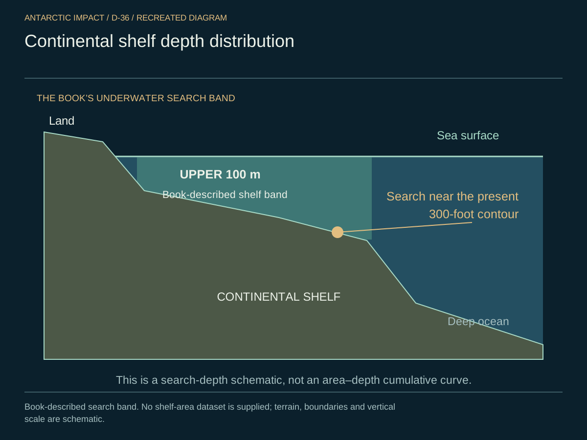
The search is concrete. Survey the paleo shorelines underwater. Target the present three-hundred-foot bathymetric contour. Look for dense habitation layers, drowned river valleys with repeated occupation strata, engineered features, harbor works, and foundations. The signature of natural geology is one thing; the signature of human settlement is another. The second lies under the first, along the old coasts of the pre-impact world, and the instruments to find it exist today.
Here is the depth distribution of the world's continental shelves as a cumulative curve. The bulk of shelf area sits in the upper hundred meters — exactly the band where the drowned world lies.
Linking to the "Land Wave"
The land wave — the shock of the Antarctic Impact — rapidly reshaped Earth's crust roughly thirteen to fifteen thousand years ago. It displaced and disrupted early human populations, forcing them to rebuild in new or altered landscapes such as Jericho or the Altiplano, while drowning the coastal heartlands of the previous world.
James Churchward and the Lost Continent of Mu
One early-twentieth-century figure who explored alternate prehistories was James Churchward, an inventor who later turned to archaeology. Churchward proposed the existence of Mu — a lost continent considered the cradle of human civilization before its destruction in a great cataclysm. Churchward's claims of an ancient landmass lost to sudden upheaval resonate with a cometary impact triggering widespread devastation.
Whether Mu is an earlier name for Atlantis or another mythical continent, legends of a global cataclysm at roughly the time we are describing echo throughout Churchward's writings and many cultural traditions — mirroring the date range we consistently encounter.
The Younger Dryas and Memories of Catastrophe
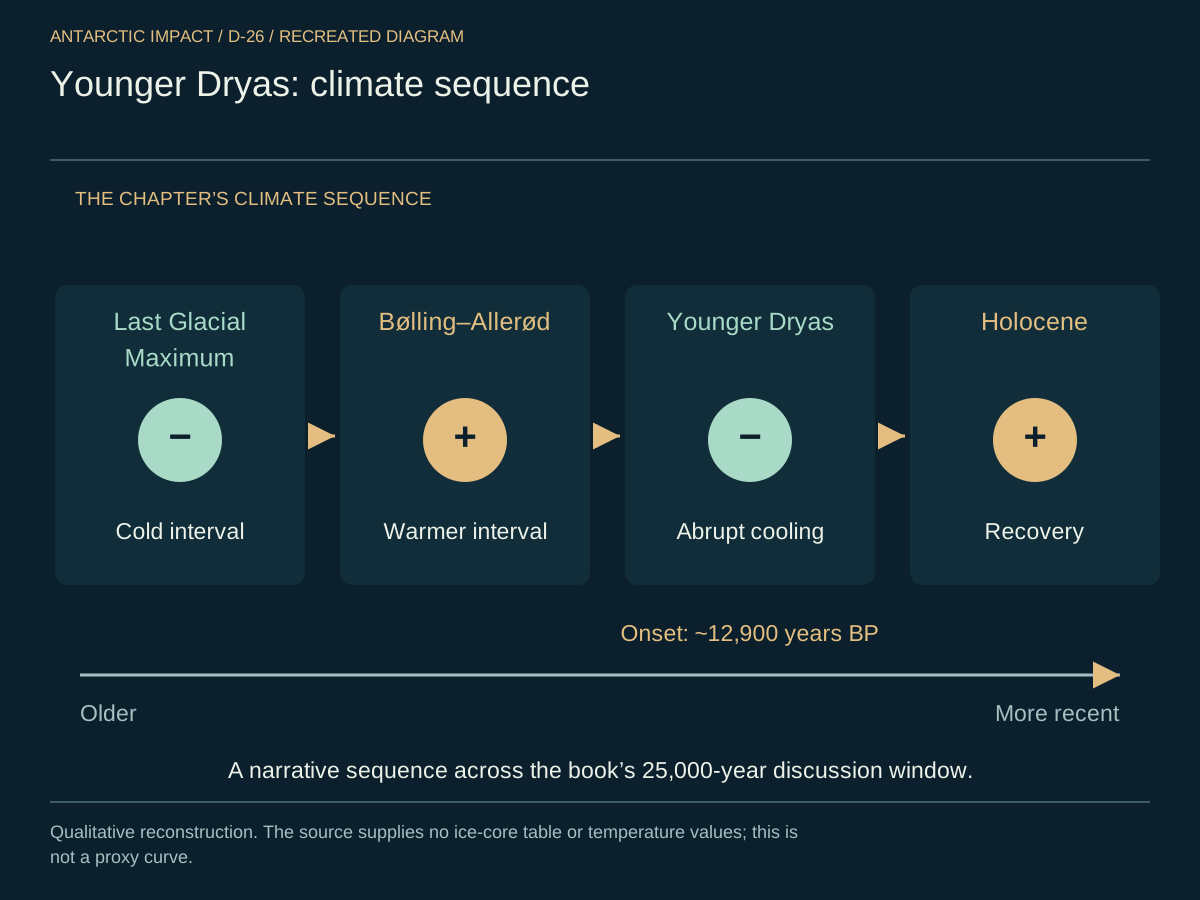
The period commencing around twelve thousand nine hundred years ago is known as the Younger Dryas — a sudden climatic shift characterized by global temperature drops. It is the climate's signature of the impact window. Myths and legends around the world — Norse tales of Ragnarök, Mesoamerican flood sagas, and others — embody cultural memories of that cataclysm.
Here is the temperature curve itself, drawn from Greenland ice-core oxygen-isotope data across the past twenty-five thousand years. The Last Glacial Maximum, the Bølling-Allerød warm interval, the abrupt Younger Dryas onset around twelve thousand nine hundred years ago, the cold plateau, and then the abrupt Holocene recovery — the shape of the curve is the signature of a blow, not a drift.
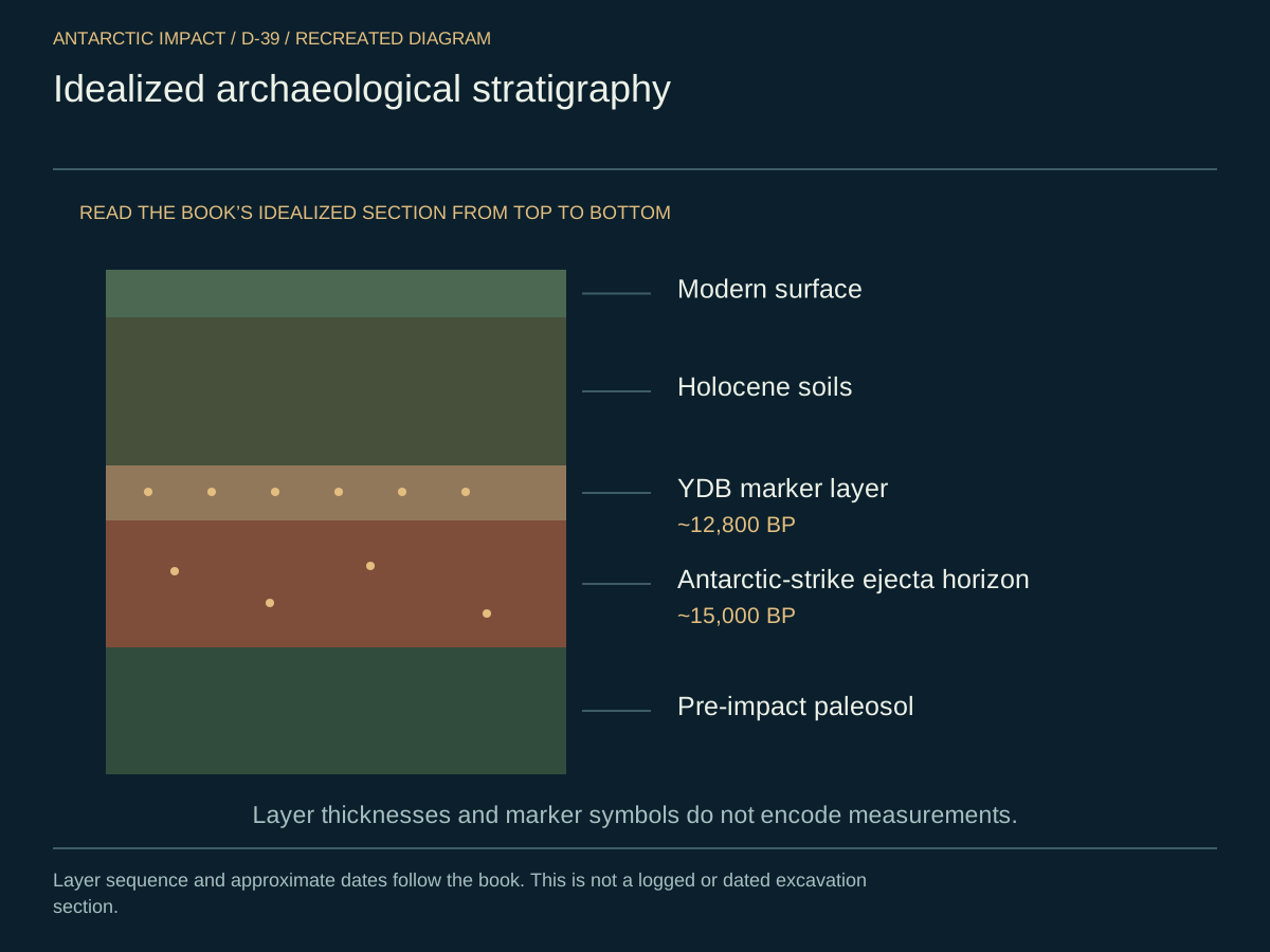
And here is the stratigraphic column for a representative North American Younger Dryas Boundary site. At the YDB layer you get a spike in microspherules, nanodiamonds, platinum, and carbon spherules — the markers of an impact, sitting at exactly the right depth.

Here is what the ground remembers at any well-chosen site, read from the top down. Modern surface. Holocene soils beneath. The YDB marker layer at roughly twelve thousand eight hundred years before present. The ejecta horizon of the Antarctic strike at roughly fifteen thousand. And below that, the pre-impact paleosol — the soil of the world before. Cut the section and read.
The megafauna pulse is the other half of the same story. Plot the extinctions continent by continent and they cluster in the twelve-to-fifteen-thousand-years-before-present window across most of the world. Africa, which sat far from the strike, shows a partial signal — exactly what a southern-polar strike predicts: the farther from Antarctica, the softer the blow.

- Ignatius Donnelly wrote about a global "Age of Fire and Gravel," linking it to Atlantis myths.
- Various indigenous traditions describe past floods or "world ages."
- New Guinea Mudmen from the Baliem Valley claim an unbroken heritage spanning ten thousand years — only "discovered" by outsiders in 1931.
These narratives all point to one ancient global catastrophe: the Antarctic Impact, thirteen to fifteen thousand years ago.
Sky-Beings and Falling Objects: A Myth Category
Step back from the individual stories and a pattern emerges. Across geographically isolated cultures, two converging categories of catastrophe story show up again and again: the world-flood story and the sky-falling story. Floods drown the old world; objects from the sky end it. Sometimes the two motifs occur in the same culture; sometimes one or the other dominates. The Aboriginal "Uluru fell from the sky" tradition belongs to the second; the Mesopotamian, Mesoamerican, and Polynesian flood narratives belong to the first. The Norse Ragnarök blends them.
The argument from convergence is straightforward: when geographically isolated cultures, with no plausible mechanism of contact, produce narratively similar catastrophe motifs, the convergence itself is evidence. The more independent the cultures, the less likely the convergence is coincidental. We are not the first to make this argument; we are the first to apply it to a specific event with a specific date.
Survivors Near the Impact Zone
The people (and fauna) closest to the comet's Antarctic collision were hit hardest, limiting technological progression and preserving an older way of life. Notable examples include:
- Patagonian Indians of southern South America
- Kalahari Bushmen of southern Africa
- Australian Aboriginal Peoples
The lands of these groups were severely disrupted, hindering large-scale cultural development and preserving older traditions long after the event.
The Australian Aborigines and the Dreamtime
Among these communities, the Australian Aborigines offer a particularly striking case. Their mythological narratives and rock art traditions trace back many thousands of years. The Australia they walk today was repopulated — closer to fifteen thousand years ago — in the wake of the comet strike.
Dreamtime Philosophies
Stories of creation, ancestral beings, and "walkabout" experiences reflect distant memories of global upheaval.
Wandjina and Gwion Gwion (Bradshaw) Rock Art
The Wandjina figures, with their distinctive haloed heads and absent mouths, and the older, elongated Gwion Gwion (Bradshaw) figures, painted in the Kimberley region of north-western Australia, together form one of the most distinctive rock-art traditions in the world. The two styles overlap geographically but belong to different periods. Some Wandjina figures have been dated to as recently as four thousand years ago; the Gwion Gwion are widely accepted as much older, with some estimates reaching back toward our impact window.
We are interested in two specifics. First, the figures often appear to be coming down — sky-beings, in posture. Second, the Wandjina iconography reads as a memory of a falling object: the haloed head, the absent mouth, the sense of arrival from above. The rock art belongs beside the impact, not in a separate puzzle.
A "Knockout" Event
According to legend, shock waves were so intense they rendered organisms unconscious, creating a collective "reset."
Uluru (Ayers Rock) Legends
A 1930s National Geographic article recorded Aboriginal oral traditions claiming Uluru "fell from the sky." Uluru — and nearby Kata Tjuta — are colossal fragments ejected from Antarctica during the impact, which explains their solitary grandeur within an otherwise flat desert.
The New Guinea Mudmen: A Ten-Thousand-Year Heritage
The Mudmen of the Baliem Valley deserve more than the single-line mention they usually get. Until 1931, no outsider knew they existed; a French aviator looking down at terraced agriculture in what was supposed to be empty highland brought their world into contact with ours. Their own oral tradition holds that they have been there, continuously, for something like ten thousand years.
The Mudmen are not interesting only because of that claim. Their masks, made of clay, and their cultural reading of being "covered" — disguised, hidden, walking through their own valley as something else — read as a survival-after-knockout cultural memory. A people who came to themselves in a disrupted world and learned to move through it cautiously.
Conclusion: Piecing Together the Human Timeline
By examining sites and legends worldwide — from Jericho to the Baliem Valley, from Mesopotamia to the Australian Outback — we consistently encounter a critical date range around twelve to fifteen thousand years ago, the window of the cataclysm. Historical and archaeological layers become murky before this point. They become murkier still on the now-drowned shelves where the pre-impact world lived.
Figures like James Churchward, Ignatius Donnelly, and countless indigenous oral traditions speak of lost lands and cosmic disasters — the record of a real cataclysm. The Antarctic Impact tilted Earth's axis, fractured continents, and drove survivors into remote refuges, and that is why so many disparate sources converge on this timeframe — and why cultures like the Australian Aborigines retain legends of a fallen sky-rock and a Dreamtime forged by celestial upheaval.
That convergence — across cultures with no plausible contact — is the part we keep returning to. That is not mythology. That is history. We just have not yet found most of it, because most of it is under water.