From a line on the ocean floor to a story of human renewal. Follow the full arc of Antarctic Impact, and the connections Michael and Ramon Madden draw between its parts.
A companion to the authors’ account · 18 connected story beats
THE SHAPE OF THE ACCOUNT
01
A world beforeJoined land. A distant precursor.
02
An arriving bodyFrozen mantle. Coherent core.
03
A force spreadingFractures. Mountains. Other worlds.
04
A long aftermathBurial. Ice. Drowned coastlines.
05
A return to the lightShelter. Memory. Renewal.
THE WHOLE ARGUMENT
A map becomes a chain of events.
The book begins at the proposed point of impact. Its questions travel outward—across Earth, into the solar system, and finally back to people.
It begins with a way of looking. In Marie Tharp's maps of the ocean floor, Michael and Ramon Madden see ridges, rifts and arcs that lead them back to Antarctica. Their book builds one sweeping account around that pattern: a giant nitrogen-ice comet arrives at a joined world, sheds its frozen mantle, and strikes with a coherent core. From that arrival, the authors trace a chain through continental separation, mountain building, ice, rising seas and human survival.
The lens keeps widening. A Greenland wedge and the Ninety East Ridge connect the Antarctic scene to the rest of Earth. Mars, the Moon, Mercury, Pluto, Triton, Uranus and Saturn's system become comparisons for a proposed shared swarm. Fossil beds and hydrocarbons carry the account into buried life; drowned shelves and stories of flood and falling sky carry it into human memory. A distant, unseen Planet Nine supplies the proposed precursor.
The final movement is human: shelter, emergence and rebuilding. The book imagines survivors above and below ground meeting again, preserving different kinds of knowledge, and remembering renewal through myth and ritual. It ends by asking what a society capable of detecting and deflecting smaller bodies should do with that vulnerability. The guide below follows the authors' narrative; the Research pages let you examine the observations, source material and model choices alongside it.
Reading source: the Vision Edition by Michael and Ramon Madden. This companion summarizes and rearranges its account; the seven chapter texts remain the reading source.
Choose a question, open its chapter, or see where it appears in the sequence below.
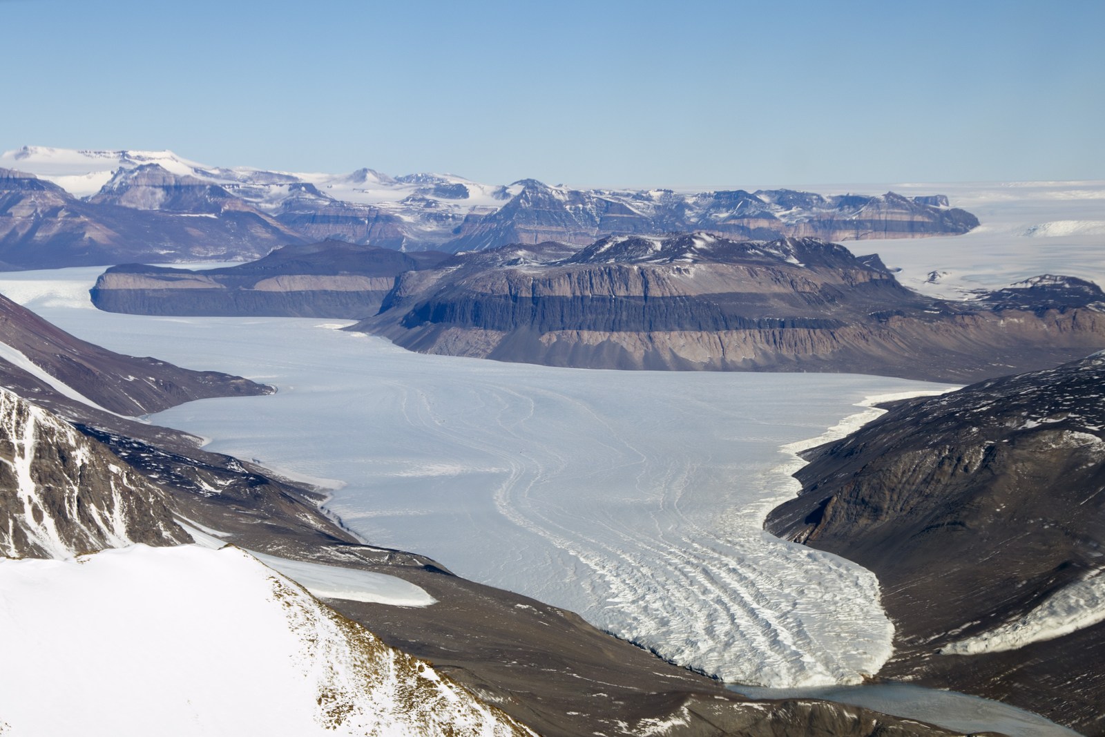
Taylor Valley: ice beside exposed rockTaylor Glacier lies beside exposed, banded rock in Antarctica’s Dry Valleys. NASA identifies sandstone layers cut by a darker dolerite sill.Michael Studinger / NASA Operation IceBridge · Original source ↗ · NASA editorial use01 / THE WOUND / ANTARCTICA
Begin beneath the ice. The East–West contrast, Wilkes Land anomaly, subglacial lakes and coal become the starting clues for the proposed collision. The chapter sets the roughly 500-kilometre nitrogen-ice body against a joined, minimally tilted Earth, then traces the primary force toward the Ninety East Ridge and Himalayas.
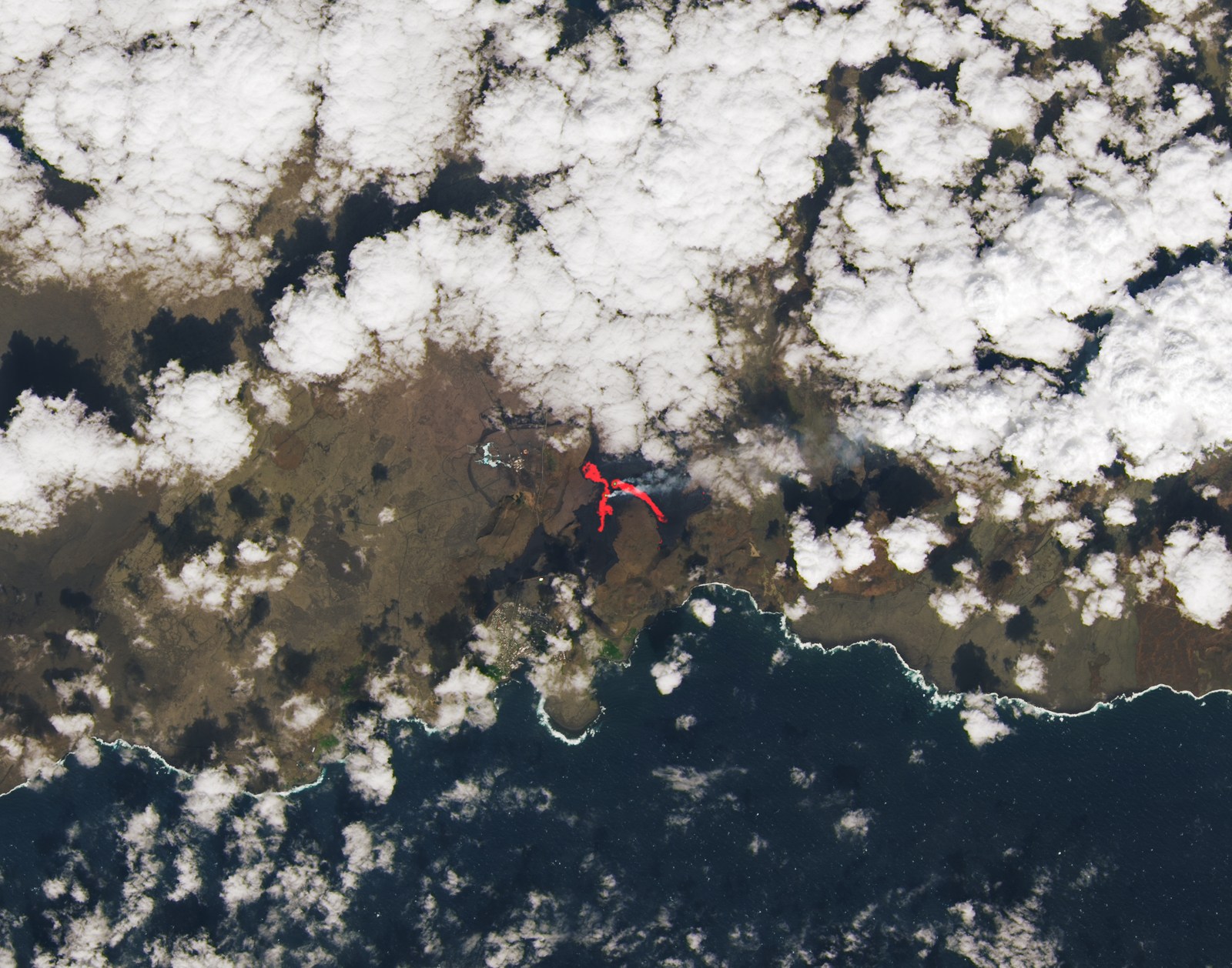
Reykjanes: an active volcanic fissureFresh and cooled lava surround a Reykjanes fissure. NASA overlays an infrared signal on natural color to reveal the hotter active areas.NASA Earth Observatory image by Lauren Dauphin, using Landsat data from the U.S. Geological Survey · Original source ↗ · NASA/USGS editorial use02 / THE MECHANISM / A WORLD IN MOTION
How does one arrival become a global chain of events?
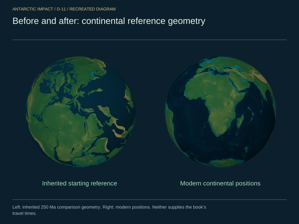
Follow the outer mantle and surviving core along different paths. Roche-limit fragmentation, cometary chemistry and nitrogen ice connect arrival to frozen fallout. The Greenland wedge, Mid-Atlantic Ridge, Andes, Pacific fractures and East African Rift build the global land-wave argument, ending with a joined-world/modern-world comparison.
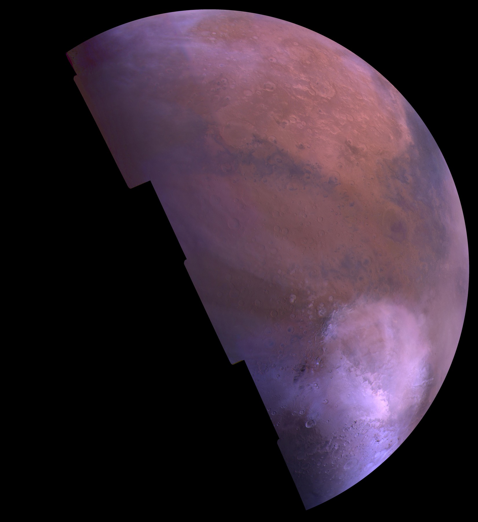
Hellas, under seasonal frostViking resolves the vast Hellas depression in Mars’s southern hemisphere. In this seasonal view, bright carbon dioxide frost fills part of the basin.NASA/JPL/USGS · Original source ↗ · Editorial reuse permitted with credit03 / THE COMPARISON / BEYOND EARTH
Travel from Hellas and Tharsis on Mars to the Moon's South Pole–Aitken basin, Mercury's Caloris, Pluto's nitrogen plain and Triton's active surface. Uranus and Saturn's moons extend the comparison to rotation and capture. The chapter draws these features into one swarm account and estimates the Antarctic body from ice and sea-level inventories.
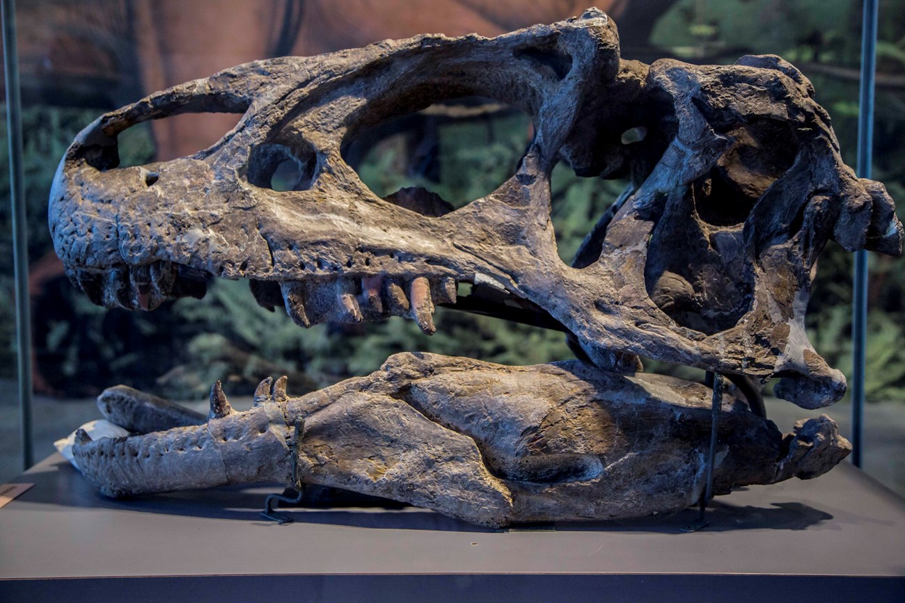
An Allosaurus skullAllosaurus fragilis from the Carnegie Quarry, Dinosaur National Monument, Utah. A museum fossil reference for the chapter’s questions about preservation.National Park Service / NPS Photo · Original source ↗ · Public domain04 / THE BURIAL / LIFE AND CHEMISTRY
What would the same catastrophe leave in the fossil and fuel record?
Visit fossil sites in Peru, Bolivia, Argentina, Queensland and Sichuan. The authors interpret preservation, marine fossils at elevation and mass burial as a recent catastrophe, and connect that burial to rapid oil and gas formation. Isotopes and amino-acid chirality appear as proposed chemical fingerprints of cometary material.
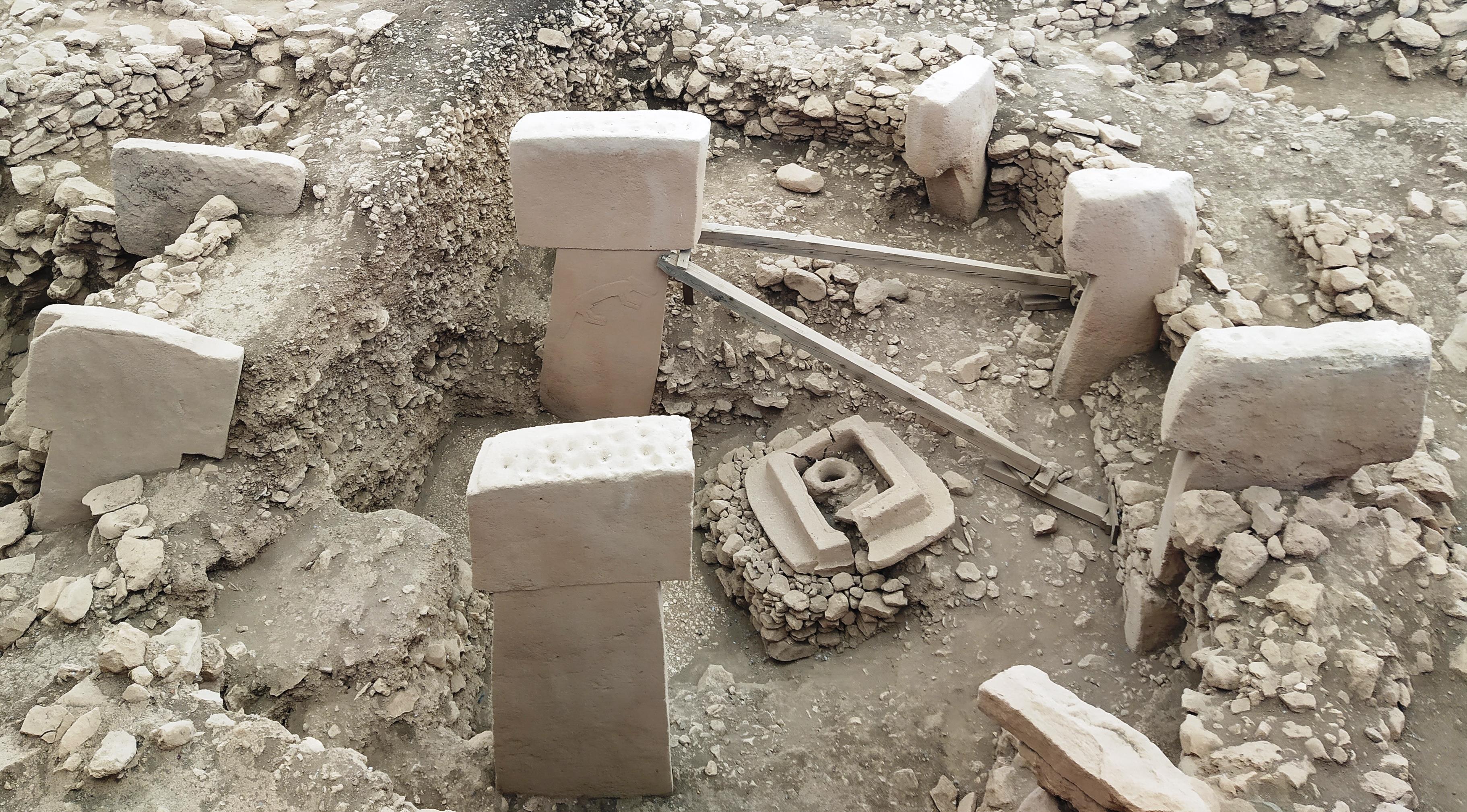
Göbekli TepeThe excavated stone enclosures at Göbekli Tepe, Türkiye, photographed in 2022. Visit the actual archaeological setting discussed in Chapter Five.Radosław Botev / Fundacja Nomos · Original source ↗ · CC BY 3.0 Poland · Display crop05 / THE LOST COAST / MEMORY AND PLACE
Where would the missing coastlines—and their stories—be found?
Move from early settlement sites to Sundaland, Sahul, Beringia and Doggerland. Drowned shelves become a search area for the world before. The chapter brings its roughly 14,500 BP convergence discussion beside Younger Dryas climate records, flood stories, falling-sky motifs and Australian rock-art traditions as the authors' account of cultural memory.
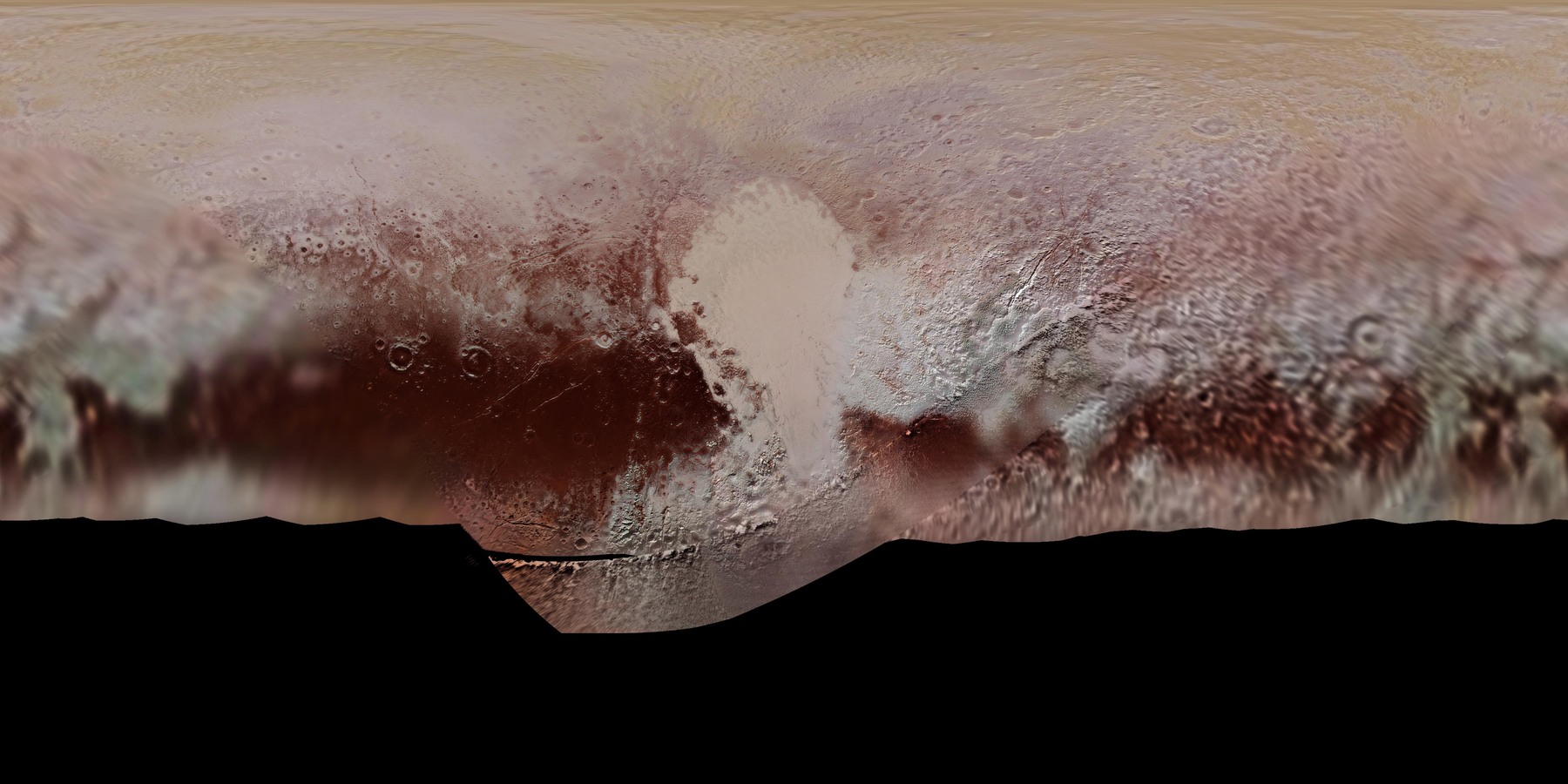
The heart, in a global mapNew Horizons mapped Sputnik Planitia as the bright western lobe of Pluto’s heart-shaped region. Its outline sits within a varied, colored landscape.NASA/Johns Hopkins University Applied Physics Laboratory/Southwest Research Institute · Original source ↗ · Editorial reuse permitted with credit06 / THE PRECURSOR / THE OUTER SOLAR SYSTEM
Step backward to the proposed source. Orbital inclinations, extreme trans-Neptunian objects and an unseen Planet Nine become the authors' explanation for a directed swarm. The chapter sets that idea within wider reservoirs of icy material and closes with the observational search for the distant object.
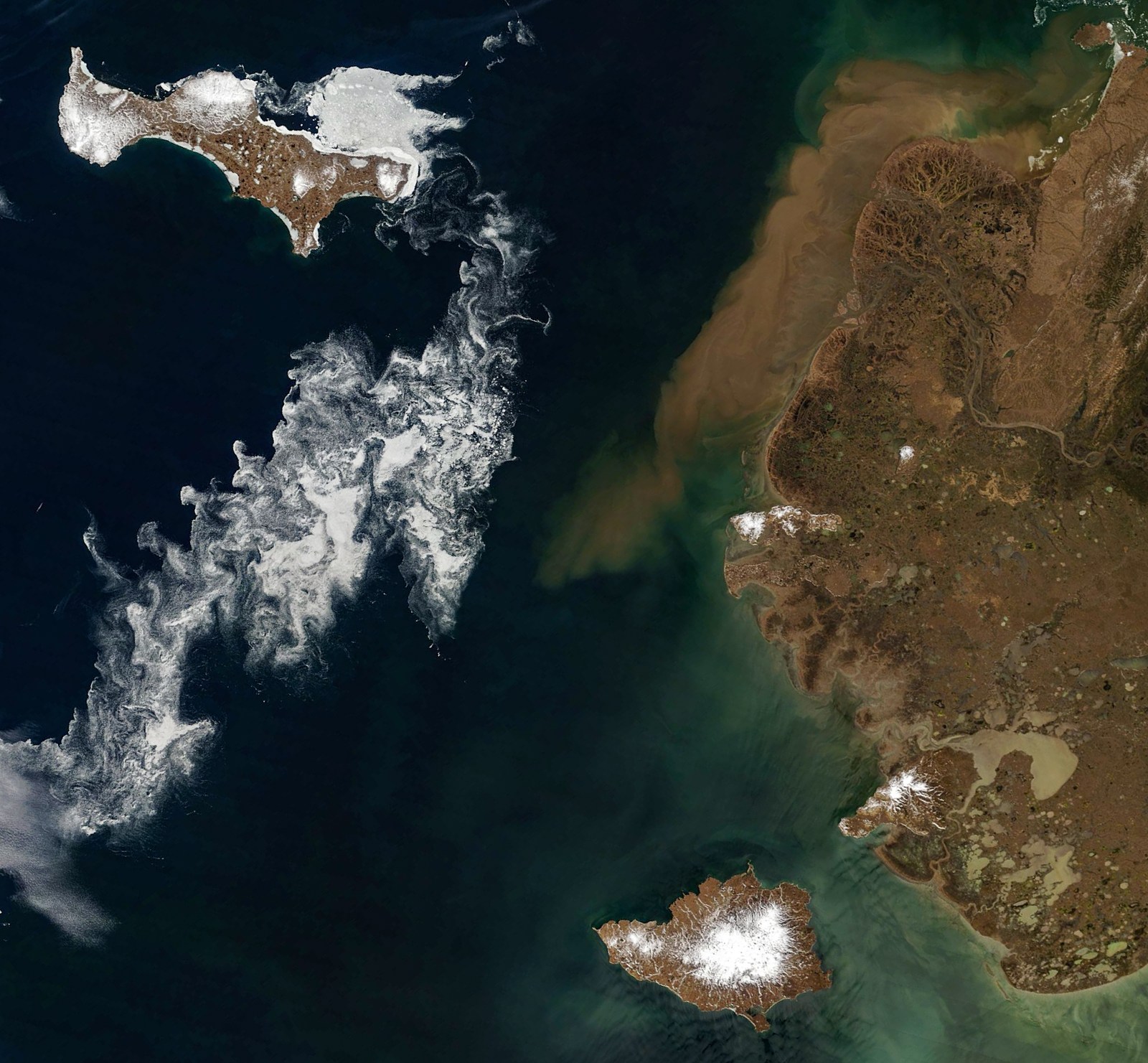
Bering Sea: islands, coast and drifting iceSea-ice fragments curl around Saint Lawrence and Nunivak islands; sediment-colored water follows the Yukon Delta coast.NASA Earth Observatory images by Michala Garrison, using MODIS data from NASA EOSDIS LANCE and GIBS/Worldview · Original source ↗ · NASA editorial use07 / THE RETURN / SHELTER AND RENEWAL
How does a story of catastrophe become a story of returning?
Return to the people. A pre-impact ecology gives way to a scenario of prepared underground refuges, hardship above ground and eventual reunion between surviving groups. Descent, emergence and renewal connect the engineering of shelter with resurrection stories. The closing pages turn toward detection, deflection, shared preparation and cooperation.
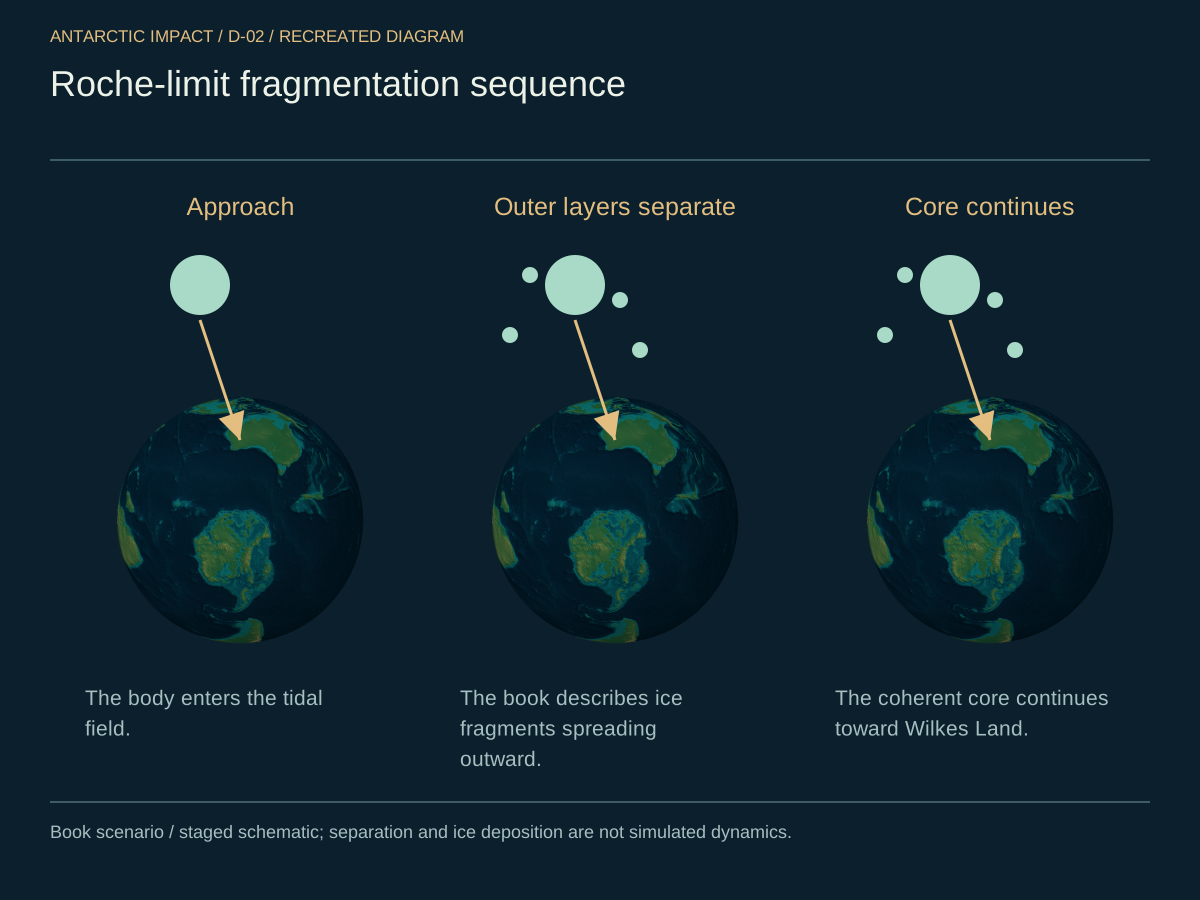
Recreated diagrams connect the arrival, the changing geography and the engineering of shelter. Alongside them, the image library opens a separate collection of real mission and field images.
The body separatesD-2 / Roche-limit fragmentationThe geography changesD-11 / Before and afterPeople find shelterD-40 / Refuge scenario
READ IN THE ACCOUNT’S EVENT ORDER
From the world before to the people after.
These eighteen beats follow the authors’ proposed sequence. Each leads to the exact book passage and a relevant diagram, 3D view or research path.
A NOTE ON TIME
The main encounter sits roughly 13,000–15,000 years ago in the book. Its ~14,500 BP convergence discussion and ~12,900 BP Younger Dryas onset remain separate markers. Seconds and minutes below come from its event diagram; the 3D player uses a presentation clock. Several responses overlap.
Showing all 18 story beats
I / BEFORE CONTACT
A world, and a warning.
The starting geography and distant precursor come from different chapters. Read together, they set the conditions for the book's encounter; the refuge story imagines what preparation might have looked like.
01
Before the proposed encounter
A joined, greener world
The starting world has a largely joined supercontinent, little or no axial tilt and a vegetated Antarctica. Chapter Seven adds warm shallow seas, megafauna and people living on coastal land that the later flood would cover. It is the landscape the authors ask us to hold in mind before everything moves.
Chapter Six reaches beyond Neptune for the cause. The authors connect orbital clustering and a recurring inclination range to an unseen Planet Nine, then propose that its passage perturbed and slingshotted icy bodies inward. This is their origin story for the swarm, rather than a dated encounter reconstructed from a known planet's orbit.
The survival scenario imagines a culture noticing an approaching threat and preparing caves or excavations with stores, water and ventilation. Cappadocia supplies an engineering comparison for the shelter layout. The book leaves the question of who foresaw the danger open before imagining how a prepared community could endure it.
The account separates a fragile outer mantle from a coherent core. Its order is important: frozen material begins spreading before the core reaches the Antarctic sector.
04
Approach · before core contact
The outer mantle breaks away
A body roughly 500 kilometres across approaches at the book's working 30–40 kilometres per second. In the nitrogen-ice scenario, mantle shedding begins near a stated Roche altitude of 13,000 kilometres. Fragments spread while the denser, coherent core keeps coming. Global frozen deposition begins here, before the strike.
Contact · within the book's ~13,000–15,000-year window
The core reaches the Antarctic sector
The surviving core strikes obliquely, at an angle the text places around 23 degrees. Wilkes Land becomes the focal point of the account: the authors identify its buried mass concentration with the core remnant and read the contrast between East and West Antarctica around that proposed arrival.
Intense pressure and heating give the proposed mechanism its moving surface. The authors describe rock passing into a plastic state, allowing crustal motion before cooling fixes the new forms. Chapter Four returns to this pressure–temperature picture when connecting deformation to rapid burial and preservation.
The manuscript compresses its first crustal changes into seconds, minutes and hours. These responses overlap; the comparison with other worlds belongs to the same broad swarm window, with no encounter order supplied.
07
About ten seconds · manuscript sequence
A line of force toward the Himalayas
The Ninety East Ridge is the main directional clue in the book's reading of Tharp's maps. Its long line toward the Great Bend becomes the path of the primary force: a way to connect an Antarctic origin to deformation far across the Indian Ocean. The text places the ridge fracture at ten seconds in its event diagram.
The D-3 sequence places India–Eurasia collision at about one minute and Himalayan uplift at about ten. Height, marine fossils and the Great Bend alignment form the chapter's mountain argument. The following chapter adds an antipodal-focusing schematic to explain how an impact could concentrate a response on the far side.
In the northward-moving branch of the land wave, Greenland acts as a hard block between North America and Eurasia. The Atlantic opens behind it, with the Mid-Atlantic Ridge read as the trailing rift. The matching margins of Africa and South America supply the familiar outline that the authors reinterpret as the result of this rapid tear.
The lens widens to the Andes, Pacific fracture zones, Ring of Fire and East African Rift. The same account connects outward-moving continents with the shift toward Earth's present tilt. Its event diagram reaches global volcanism at an hour; later activity becomes a continuing adjustment to the proposed blow.
Concurrent comparison · relative encounter order unspecified
The same swarm, beyond Earth
The book places Earth inside a wider encounter. Hellas and Tharsis, South Pole–Aitken, Caloris, Sputnik Planitia, Triton's nitrogen ice, Uranus's tilt and Saturn's captured fragments become its comparison set. Observed landforms and materials supply the starting images; a common recent cause and directional arrival are the authors' proposed connection.
Burial, ice, weather and rising water connect the day of contact to changes lasting generations. The book then reads climate layers and archaeological gaps beside that proposed chain.
12
During and after the proposed land wave
Life is buried; chemistry becomes a clue
The fossil tour moves through Antamina, Toro Toro, Neuquén, Richmond and Zigong. The authors connect their preservation and setting to flash burial, then extend the same heat-and-pressure event to oil and gas. Nitrogen isotopes and amino-acid chirality become proposed ways of distinguishing delivered cometary material from terrestrial sources.
Fallout begins before contact; climate aftermath continues
A frozen mantle becomes a changing climate
The mantle that began shedding on approach is now the bridge to the book's Ice Age account. The authors connect deposited ice, sublimation, dust, extreme weather and corrosive rain to a long unsettled aftermath. Antarctic and Greenland inventories later become their check on the scale of the incoming body.
The book's roughly 300-foot sea-level rise turns inhabited shelves into a drowned world. Sundaland, Sahul, Beringia and Doggerland give that loss a geography. The authors turn the missing settlements into a search proposal: investigate old shorelines, river valleys and possible engineered features beneath the present sea.
Separate markers within a broad prehistoric window
Dates, layers and early places
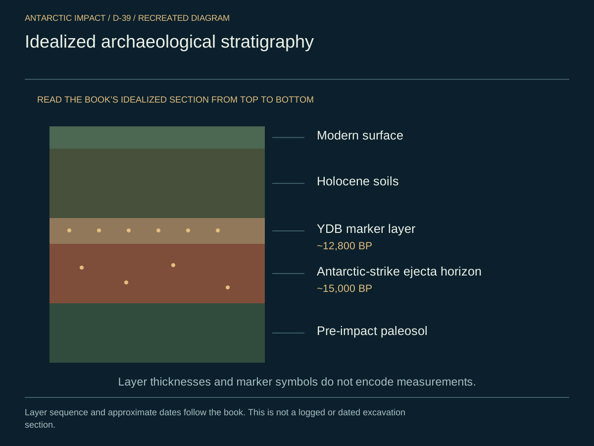
Chapter Five’s idealized section places a proposed Antarctic ejecta horizon near 15,000 BP and a Younger Dryas Boundary layer near 12,800 BP. The roughly 14,500 BP convergence discussion and 12,900 BP climate onset are separate markers. Offshore, the book proposes surveying the roughly 300-foot contour for drowned river valleys, repeated occupation deposits and possible harbor works or foundations.
The final part of the account moves from survival to reunion, from remembered catastrophe to renewal, and from the ancient story to a present-day question about preparation.
16
After surface conditions stabilize · duration unspecified
Sheltered and surface survivors meet again
Chapter Seven imagines sheltered survivors coming back into daylight after conditions stabilize. They meet people who have already begun rebuilding above ground. In the book’s account, the sheltered group brings practical knowledge, while the surface survivors carry memories of the catastrophe.
Flood, falling sky, descent and emergence carry the account into myth. Chapter Five looks for recurring catastrophe motifs; Chapter Seven turns to Osiris, Persephone, Ragnarök, resurrection and the egg. The shared shape—loss, shelter and return—is the authors' thread connecting a changed planet to cultural remembrance.
The book closes with an unseen planet to search for and a practical appeal for detection, deflection, shelters and cooperation. Rubin/LSST, JWST and the DART demonstration frame its argument for preparedness. The historical account ends here; the research path begins with examining the observations and testing the proposed connections.